Subject: New York
Period: 1849 (circa)
Publication: The Documentary History of the State of New York
Color: Black & White
Size:
8.8 x 11 inches
22.4 x 27.9 cm
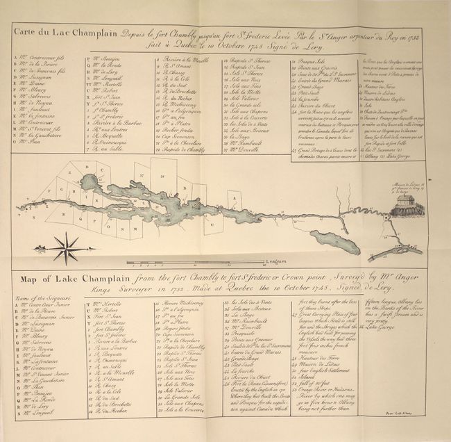
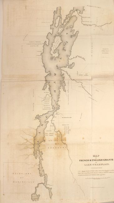
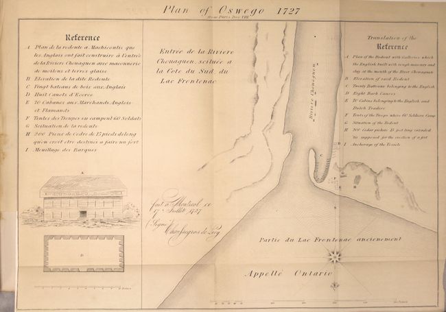
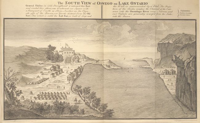
This lot consists of two disbound chapters from The Documentary History of the State of New York. The Lake Champlain chapter consists of 30 pp. with two maps: Carte du Lac Champlain (12.5 x 13.2") and Map of French & English Grants on Lake Champlain (12.7 x 22.5"). The later map details the grants along both sides of the shore with landowner's names. Notation on map explains coloring: "N.B. French Grants included within yellow lines, English de. within Black lines, except the grant to Dominie Dellius in 1696, the northern part of which is laid down, and included within Red lines" (please note this map is not colored). Locates the Seigniory of Alainville and the Seigniory of Hocquart. Extends to show part of Lake George. The Fort Oswego chapter contains 38 pp. of text with one view and the following three maps: Plan of Oswego 1727 (14.7 x 10"), English Plan of the Forts Ontario & Oswego (5.5 x 8.7"), and French Plan of Forst Ontario & Pepperell or Chouguen (6.8 x 8.7").
References:
Condition: B+
Overall the maps are clean and bright with a hint of pleasant toning. The map of the grants on Lake Champlain has light staining and offsetting (B) and one of the small maps is loose. Disbound report text is very good with occasional scattered foxing.