Subject: Nantucket, Massachusetts
Period: 1880-92 (dated)
Publication:
Color: Black & White
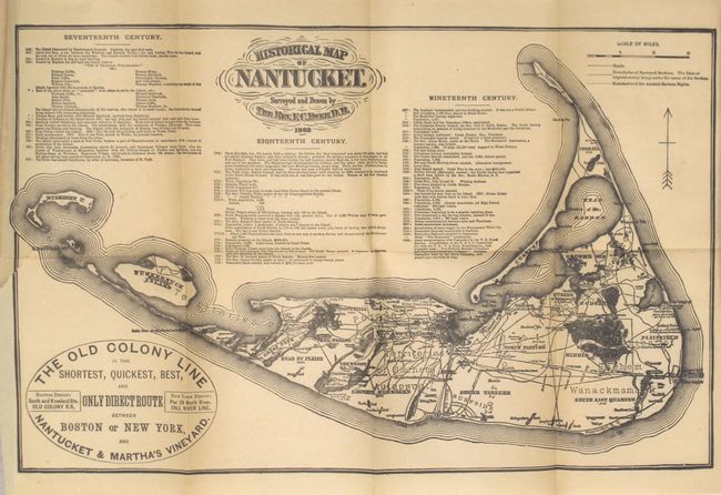
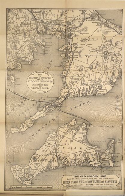
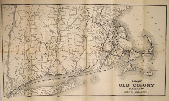
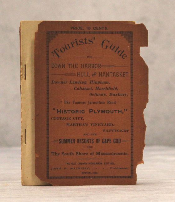
A. Historical Map of Nantucket [in] Tourists' Guide to Down the Harbor, Hull and Nantasket, Downer Landing, Hingham, Cohasset, Marshfield, Scituate, Duxbury, "The Famous Jerusalem Road," "Historic Plymouth," Cottage City, Martha's Vineyard, Nantucket, and the Summer Resorts of Cape Cod and the South Shore of Massachusetts, by John F. Murphy, published 1892 (4.3 x 6.1"). This folding ephemeral pocket map (13.3 x 8.5") extends to show Muskeget and the Huckernuck islands. It advertises "The Old Colony Line is the Shortest, Quickest, Best, and Only Direct Route between Boston or New York, and Nantucket & Martha's Vineyard." The map is a reproduction of the one surveyed and drawn by the Rev. F.C. Ewer in 1869 and shows roads, villages and the boundaries of the Ancient Sachem Rights. It also includes a chronology of historical events from 1602 to 1885. The other folding maps are the Old Colony Line Map of Martha's Vineyard and Summer Resorts (9 x 14") and Old Colony Railroad and Connections (17.3 x 9.5"), which includes Connecticut, Rhode Island and Massachusetts. In original orange wrappers, 24mo, 95 pages including numerous text illustrations and 3 folding maps. Condition: The maps are overall clean and bright. The Nantucket map has a short biding tear at left that just enters the border. Text is very good with minor soiling, and the front paper wrapper has detached. (B+)
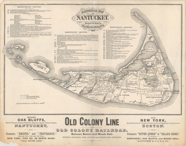
B. Historical Map of Nantucket, by Reverend F.C. Ewer D.D., circa 1880 (13.8 x 8.6"). This is a different reproduction of the Ewer map of Nantucket from above. This version, printed on heavy paper, includes approximately 2 inches of advertising below the map promoting the Old Colony Line between Boston and Woods Holl [sic], as well as the steamships Bristol, Providence, River Queen and Island Home. Condition: Fold separations at top and bottom have been repaired on verso with archival tape. There are two tiny holes adjacent to the centerfold that are only visible when held to light, and a few small chips in the bottom blank margin. (B)
References:
Condition:
See description above.