Subject: Western United States
Period: 1879-95 (circa)
Publication:
Color:
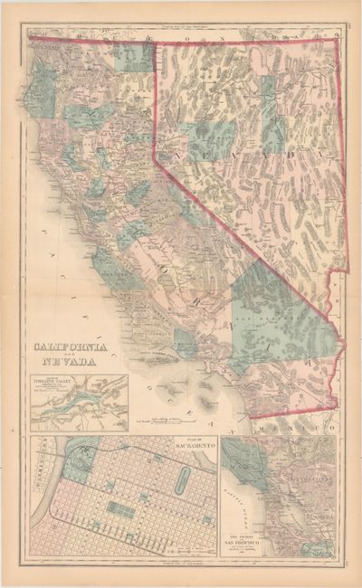
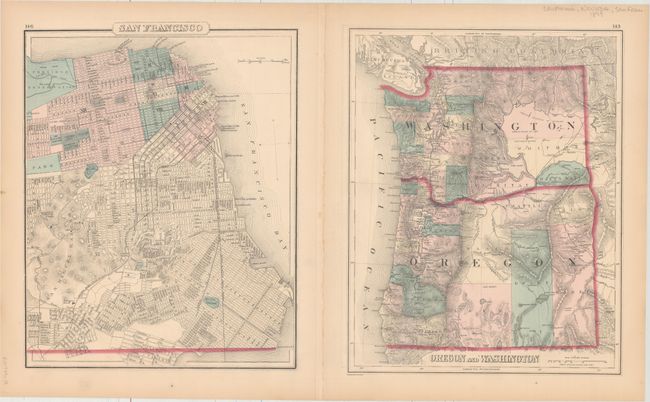
A. California and Nevada [on verso] Oregon and Washington [and] San Francisco, by F.A. Gray, circa 1879, hand color (16.3 x 26.1"). This is a beautifully colored and engraved double-page map showing numerous named railroads, cities and towns, watershed, forts, and more. Three large insets: Plan of Sacramento; The Vicinity of San Francisco; and Map of the Yosemite Valley. Early railroads extend from Los Angeles north to Redding and east to San Bernardino; the Central Pacific crosses Nevada to Sacramento; several spurs radiate from the San Francisco Bay area. County development is accurate to 1874 except the border between San Bernardino and Inyo counties is incorrectly shown pre-1872. On verso are two full-page maps: a fine street plan of San Francisco, and Oregon and Washington. A large and handsomely colored map of California. Condition: Light toning, faint offsetting, and a fold separation that enters 2" into the image at left that has been closed on verso with archival tape.
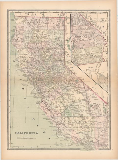
B. California, by Mitchell/Bradley, circa 1888, printed color (16.4 x 22.4"). Nice double-page map of the state with an inset showing San Bernardino and San Diego counties at top right. Shows the extent of surveying which is nearly complete. Details include railroads, cities and towns, rivers, lakes and mountains. Condition: Light toning along the centerfold and sheet edges.
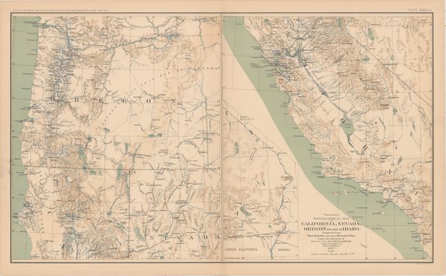
C. "Essayons" Topographical Map of California, Nevada, Oregon and Part of Idaho..., by U.S. War Department, from Atlas to Accompany the Official Records of the Union and Confederate Armies, 1861-1865, published 1891-95, printed color (27.6 x 16.4"). This large sheet has two maps. The map on the right (14" x 16.5") covers most of California from Yuba City south to the border with Mexico. The southeast corner of the state continues in a large inset on the same scale. Topography is shown via fine shading and watershed is shown via attractive blue overprinting. There is much military information: forts, barracks, wagon roads, etc. Drum Barracks is located next to Wilmington in Southern California. The left side of the sheet shows Oregon and the northern portions of California and Nevada in the same detail as the first. The full page is Plate CXXXIV. Dated 1867 but published 1892. Condition: Light toning and color offsetting.
References:
Condition: B+
See description above.