Subject: Colonial Mid-Atlantic United States
Period: 1767 (circa)
Publication: A New Geographical and Historical Grammar
Color: Black & White
Size:
7.8 x 5.7 inches
19.8 x 14.5 cm
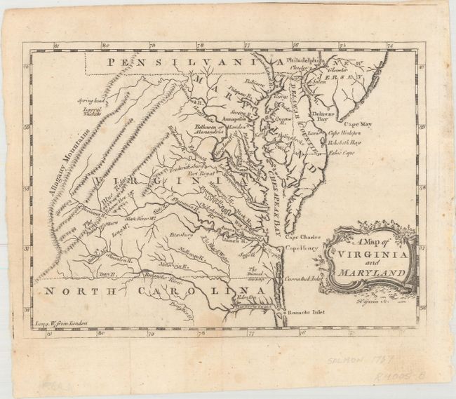
Of the dozens of editions of A New Geographical and Historical Grammar that were published, this map appeared only in the 1767 edition. The map focuses on the topography and towns in the region, and extends to show Delaware and parts of South Carolina, Pennsylvania and New Jersey. The dotted borders between the states are quite irregular, and appear to have been drawn freehand. The map appears to be a derivative of the Fray & Jefferson map of Virginia from 1753 based on the shape of the Delmarva Peninsula. Engraved by H. Gavin. A very scarce map.
References: Sellers & Van Ee #1391; McCorkle (18th C. Geog. Books) #364 [28].
Condition: B+
Issued folding, now pressed with minor foxing, an archivally repaired tear that enters 1/2" into image at right, and a weak impression along neatline only in bottom corners.