Catalog Archive
Auction 159, Lot 132

"ABC The Pathfinder Railway Guide Map. Eastern Section", Railroad Companies, (Various)

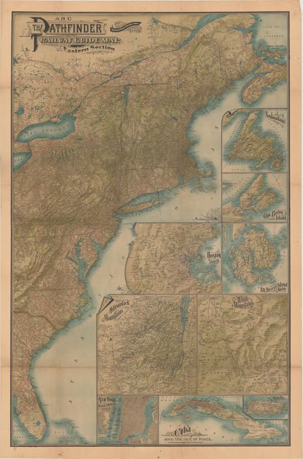
Subject: Eastern United States & Canada

Period: 1901 (dated)

Publication:

Color: Printed Color

Size:
27.9 x 42.9 inches
70.9 x 109 cm
Download High Resolution Image
(or just click on image to launch the Zoom viewer)

This incredibly detailed traveler's map covers the entire eastern seaboard from New Brunswick to Florida at the turn of the 20th century. It displays topography in various shades of green and depicts a dense network of railroad lines in red overprinting with all stations identified. The Atlantic Ocean is filled with 9 inset maps showing Boston, New York, the Adirondacks, and Cape Breton Island, etc. Issued by the New England Railway Publishing Company in Boston.

References:

Condition: B+

Issued folding with numerous small splits at fold intersections and a 4.5" fold separation below Lake Erie that has been closed on verso with archival tape.

Estimate: $150 - $180

Sold for: $220

Closed on 9/14/2016

Archived