Subject: World
Period: 1664 (circa)
Publication:
Color: Hand Color
Size:
18.8 x 12.1 inches
47.8 x 30.7 cm
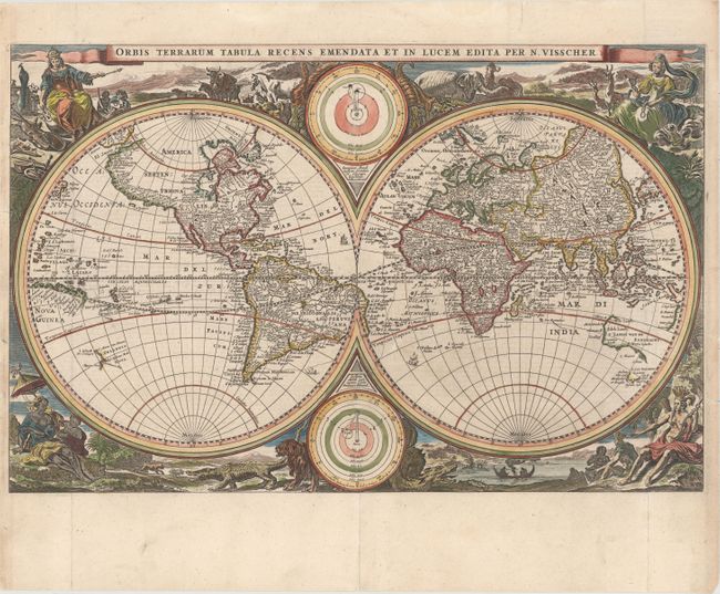
This superb double hemisphere world map is surrounded by engravings including allegorical representations of the continents as well as native inhabitants and wildlife. Visscher's decorations were so popular several other cartographers copied them. Two diagrams depicting the Ptolemaic and Copernican theories of the solar system appear within the cusps of the hemispheres. The northwest coast of North America is greatly exaggerated with the fictional El Streto d'Anian, while California is shown as a peninsula. In the Pacific, Western Australia, Van Diemens Landt and a bit of New Zealand are also noted. This is the first state. Dutch text on verso.
References: Shirley #431; Poortman & Augusteijn #118.
Condition: B+
Excellent impression and color, issued folding and now pressed with professional repairs to separations along the centerfold. A 2" tear extending from the centerfold at bottom into the south Atlantic in the eastern hemisphere has also been professionally repaired. There are a few tiny edge tears at right and left that have been archivally repaired.