Subject: North America
Period: 1834-43 (dated)
Publication:
Color: Black & White
Size:
12.3 x 15.1 inches
31.2 x 38.4 cm
The beginning of the nineteenth century saw a period of rapid market growth and innovation in the map publishing world. Increased literacy and public interest in new frontiers and colonies overwhelmed the market because it was oriented toward the small, affluent market of the previous century. With the intent to fill this void, The Society for the Diffusion of Useful Knowledge (SDUK) was founded in 1828 in London, by Lord Brougham and a group of men dedicated to the education of the aspiring working class and the Utilitarian ideal of 'Knowledge is Power.' The society produced an array of education materials, but the series of maps was one of their most successful ventures. A number of engravers and printers were used to produce the maps, which eventually exceed 200 sheets, and continued to be published after the Society as a whole ceased to function.
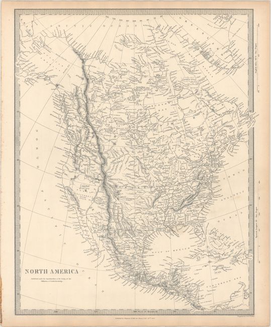
A. North America, dated 1843. Detailed and finely engraved map that portrays an Independent Texas, with Mexico controlling Nueva California. The boundary between Canada and the United States is left unengraved, leaving the ownership of Oregon Territory (here labeled Columbia) unknown, which is unusual for a British map. Filled with well-developed topography, the map names numerous forts, trading posts, Indian tribes and locates L. Youla roughly near the Great Salt Lake with the American Fur Depot on its eastern shore. The R. Buenaventura extends to the Pacific from two branches, one originating from a large swamp in the Great Basin. The course of the Snake River is fairly accurate, but the Colorado River originates too far north and rushes to the Sea of Cortez in a straight line. Locates the 3 buttes in present-day Idaho -- important landmarks on the Oregon Trail. Lake Michigan retains its erroneous elongated shape. Distance scales outside of border give English Miles and Spanish Leagues. Engraved by J. & C. Walker and published by Chapman & Hall.
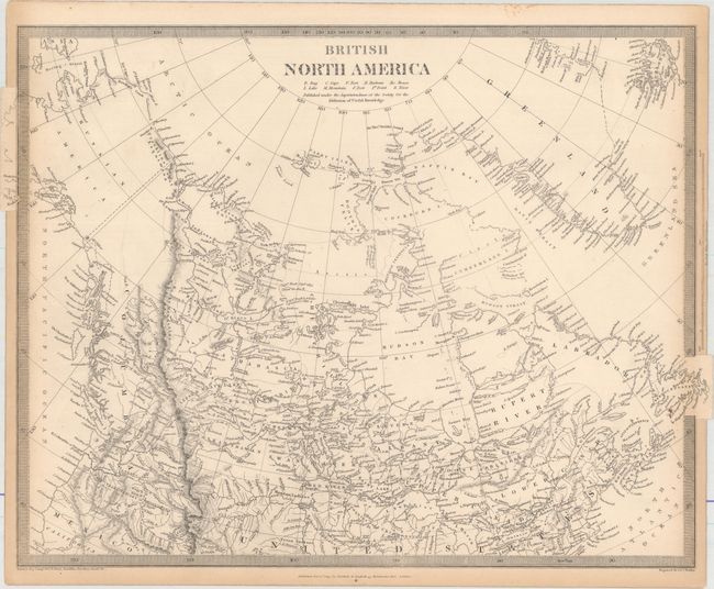
B. British North America, dated 1834. This steel engraved map covers all of present-day Canada with its southern boundary with the United States extending to the Columbia River, illustrating British claims in the region.
The Canadian Arctic region is largely unmapped and much of the interior is shown with limited detail, attesting to the knowledge of the day. Keyboard style borders.
References:
Condition: B+
Mostly clean and bright with light toning along sheet edges.