Catalog Archive
Auction 158, Lot 62

"Bowles's New One-Sheet Map of America, Divided Into Its Kingdoms, States, Governmts. and Other Subdivisions...", Bowles & Carver

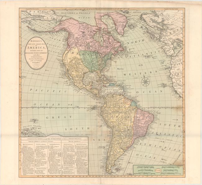
Subject: Western Hemisphere - America

Period: 1803 (circa)

Publication:

Color: Hand Color

Size:
22.3 x 22.5 inches
56.6 x 57.2 cm
Download High Resolution Image
(or just click on image to launch the Zoom viewer)

A handsome and very detailed map of the Americas with an extensive key to the colonial possessions. In North America, the United States extends to the Mississippi River and there are 14 states listed. Louisiana is colored in the map as a U.S. possession, but the table still lists it under French control. Spain is shown in control of New Mexico and Florida. The British possessions in Canada extend south on the west coast to the Columbia River. In South America, Spain and Portugal dominate the continent.

References:

Condition: B+

Original color with light scattered foxing primarily along the folds and a short fold separation at the joint.

Estimate: $500 - $700

Sold for: $300

Closed on 6/22/2016

Archived