Catalog Archive
Auction 158, Lot 361

"Les Environs de Rome", Fer, Nicolas de

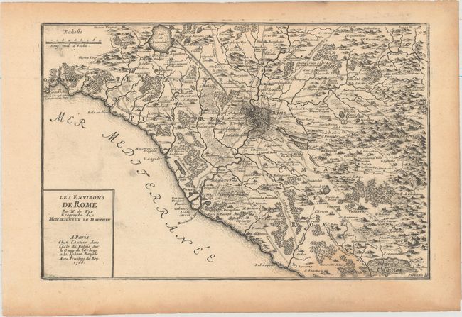
Subject: Western Italy, Rome

Period: 1705 (dated)

Publication: L'Atlas Curieux

Color: Black & White

Size:
13.6 x 9.1 inches
34.5 x 23.1 cm
Download High Resolution Image
(or just click on image to launch the Zoom viewer)

This is a very fine map of the region surrounding Rome with the major roads delineated, including the Via Appia through the Pontine Marshes. The map extends north to Lake Bracciano and south to Sermoneta, with Rome illustrated in plan-view format. The map is accompanied by a sheet of text describing the region.

References:

Condition: B+

Light toning along the edges of the sheet with a damp stain that enters image at bottom right.

Estimate: $160 - $190

Unsold

Closed on 6/22/2016

Archived