Subject: World, Eclipse
Period: 1747 (dated)
Publication:
Color: Hand Color
Size:
21.9 x 18.5 inches
55.6 x 47 cm
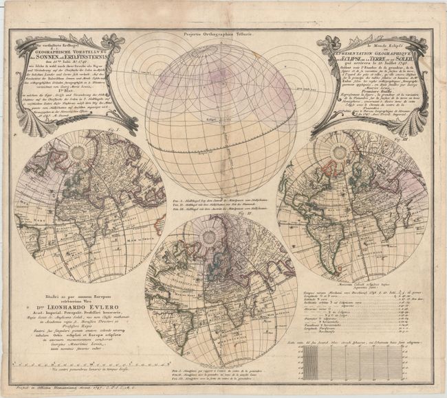
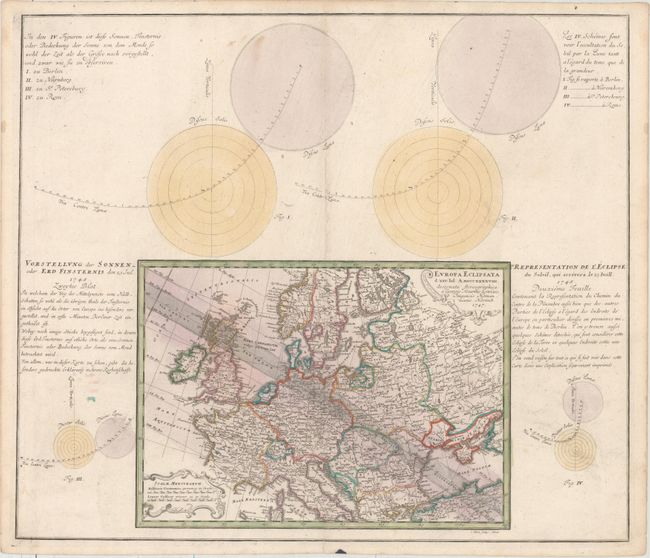
This matching pair shows the predicted path of a solar eclipse on July 25, 1748 based on calculations by Leonhard Euler, a renowned mathematician and astronomer. The first sheet includes three hemisphere projections depicting the locations of the penumbra, or shadows caused by the eclipse, during three different time periods. Geographically the hemispheres are fairly rudimentary, with only major rivers and place names identified. In North America the South is labeled Florida Louisiana and the Pacific Northwest is labeled Nova Albion. The second sheet gives a more detailed view of the passage of the eclipse through Europe, surrounded by four figures of the sun and moon that identify the optimal viewing of the eclipse in Berlin, Nuremburg, St. Petersburg, and Rome. Created by George Moritz Lowitz. The first sheet was engraved by Ruprecht Adam Schneider and the second sheet was engraved by S. Dorn. A rare pair of maps.
References:
Condition: B+
Original color with light soiling, which is more prominent along the centerfold of the first sheet. The first sheet is issued folding, now pressed.