Subject: Northern England
Period: 1713 (circa)
Publication: England Fully Described in a Compleat Sett of Mapps...
Color: Hand Color
Size:
19.9 x 15 inches
50.5 x 38.1 cm
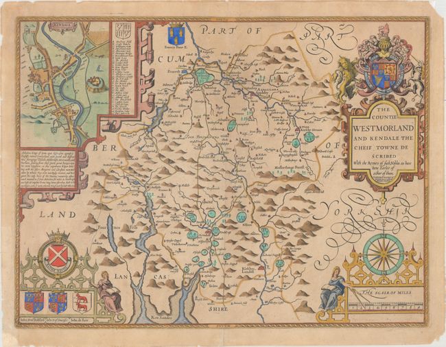
Attractive map of the historic county of Westmoreland, now known as Cumbria. The map is filled with place names and much topographical detail, including scores of tiny, fenced compounds shown across the map with names like Brigster Park, Colnhead Park, Crosbye, and Midleton. Windermere is called Wynandermere, near the Wynander Mere flud (now called Windermere Lake). A large strapwork inset depicts a bird's-eye plan of Kendal, with a lettered key identifying numerous locations. The map is highly adorned with the Royal Arms sitting atop the title cartouche, a scale of miles featuring a large compass rose and a female figure, several family coats of arms. With the imprint of Henry Overton, who acquired the plates around 1713 from Christopher Browne.
References: Shirley (BL Atlases) T.SPE-1l.
Condition: B+
Watermarked paper with light toning and a number of small chips and tears in the blank margins, most of which have been archivally repaired. Remnants of hinge tape on verso.