Catalog Archive
Auction 158, Lot 187

"Carte de Colombie Contenant les Republiques de la Nle. Grenade, de Venezuela, de l'Equateur et les Guyanes", Lapie/Tardieu

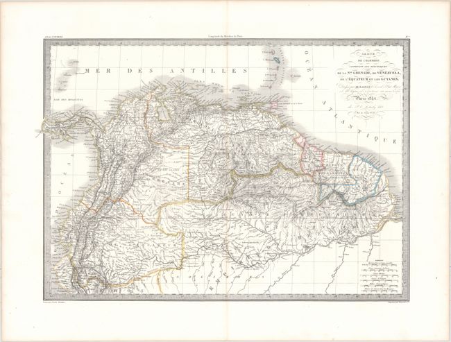
Subject: Northern South America

Period: 1842 (dated)

Publication: Atlas Universel de Geographie Ancienne et Moderne…

Color: Hand Color

Size:
22.3 x 15.6 inches
56.6 x 39.6 cm
Download High Resolution Image
(or just click on image to launch the Zoom viewer)

This intricately engraved map of northern South America extends as far south as northern Peru and Brazil, although there is little detail south of the Amazon River. Numerous place names, rivers, lakes, tribes, and more are located, and the topographical detail is excellent. There are six distance scales at bottom right. Engraved by Tardieu and printed by Kaeppelin and Co.

References:

Condition: A

A crisp impression on a clean sheet with original outline color. There is faint toning along the centerfold.

Estimate: $170 - $200

Unsold

Closed on 6/22/2016

Archived