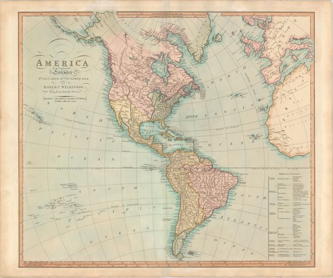
Subject: Western Hemisphere - America
Period: 1826 (dated)
Publication:
Color: Hand Color
Size:
23.6 x 20.4 inches
59.9 x 51.8 cm
This handsome map of the Americas shows the United States extending west to the Mississippi and Mexico extending north of the Great Salt Lake, here called Timpanogos Lake. Greenland is shown connected to Canada and the northern portions of Canada remain largely blank. A number of cities and rivers are named throughout. A table at bottom right identifies the various European possessions in the Americas. At the bottom of the table, the Native Americans are noted as being located in North America in Mosquito Shore &c. and in South America in Patagonia &c..
References:
Condition: A
A crisp impression with full original color on paper watermarked "J. Whatman 1825." There are archivally repaired centerfold separations that enter about 1" into map at top and bottom. Light toning along edges of sheet.