Subject: References
Period: 1973-2004 (published)
Publication:
Color: Printed Color
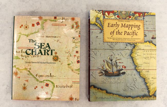
A. The Sea Chart - An Historical Survey Based on the Collections in the National Maritime Museum, by Derek Howse and Michael Sanderson, published 1973, (8.9 x 11.1"). An excellent history of nautical charts, based on the collection of the National Maritime Museum of Greenwich. This useful and interesting history of marine cartography has illustrated examples from 1420 to 1971, with the majority predating 1800. Sixty plates of sea charts, some in color with accompanying essays. Hardbound in red cloth with dust jacket, 144pp. Condition: Contents near fine with a hint of toning along the sheets' edges. Covers near fine with slight wear. The dust jacket has minor wear and is clipped on the inner front cover.
B. Early Mapping of the Pacific - The Epic Story of Seafarers, Adventurers, and Cartographers Who Mapped the Earth's Greatest Ocean, by Thomas Suarez, published 2004, (9.4 x 12.3"). This book traces the exploration of the Pacific Ocean through milestones in the mapping of the region. The author does an excellent job integrating the history of exploration and cartography and the book is richly illustrated with maps and early views. Published by Periplus Editions, Singapore. 224 pp. including bibliography and index. 223 beautiful illustrations, mostly in color. Hard illustrated cover with illustrated dust cover. Condition: Contents tight and covers near fine. The dust jacket has a minor amount of wear.
References:
Condition: A
See description above.