Subject: References
Period: 1899-2002 (published)
Publication:
Color:
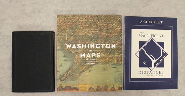
A. Annual Addresses of the President of the Medical Society of the District of Columbia Delivered 1894-95-96-97-98, by Samuel C. Busey, published 1899, black & white (6.0 x 8.8"). This fascinating reference collects addresses to the Medical Society of the District of Columbia, addresses that, according to Busey's introduction, "set forth and emphasize the advance of the Society along the line of scientific medicine and its activity in the promotion of State medicine and public hygiene." Of interest to map collectors are four black and white plates included in the book: Sketch of Washington in Embryo..., originally compiled in 1874 by E.F.M. Faehtz and F.W. Pratt; a view of Washington, dated 1833; a reproduction of Thackara and Vallance's important 1792 map of the city; and Territory of Columbia, a map drawn by Andrew Ellicott and engraved by P.A.F. Tardieu, dated 1815. Hardbound with gilt title on the spine, 178 pp. This is a discarded duplicate copy from Welch Medical Library at John Hopkins University. Condition: Contents lightly toned with small stains along the top of the pages in the back half of the book. The binding is loose, and three of the four plates are detached. Covers good with light wear to the spine and minor soiling. (B)
B. Washington in Maps 1606-2000, by Iris Miller, published 2002, printed color (9.3 x 11.1"). Iris Miller uses her skills as a professional landscape architect and urban planner to present a historical timeline of Washington, D.C. with the help of maps, letters, charts, and other historical documentation. Spanning over four centuries, this book features about 80 maps and over a dozen illustrations, most in full color, from Thomas Jefferson, Pierre Charles L'Enfant, Captain John Smith, the Senate Park (McMillan) Commission, and many others, as well as satellite images from modern times. Miller combines these images with fifty-two explanatory essays, drawing a connection between design intent and urban meaning from cartography. 176 pp., hard bound in blue cloth, with illustrated dust jacket. Condition: Contents tight with very minor shelf wear to the spine. (A)
C. City of Magnificent Distances - The Nation's Capital - A Checklist, by Andrew J. Cosentino and Richard W. Stephenson, published 1991, black & white (8.4 x 11.0"). This useful checklist published by the Geography and Map Division of the Library of Congress includes over 400 entries of maps and cartographic items related to the United States' capital city. The list spans from the earliest maps and plans of the city to contemporary works. There is an introduction and notes at the head of each section, as well as short descriptions for each listing. Paperback with illustrated covers, 31 pp. Condition: Contents tight with minor wear to the covers. (A)
References:
Condition:
See description above.