Subject: History Books, Caribbean
Period: 1793-1801 (published)
Publication:
Color: Black & White
Size:
8.5 x 11 inches
21.6 x 27.9 cm
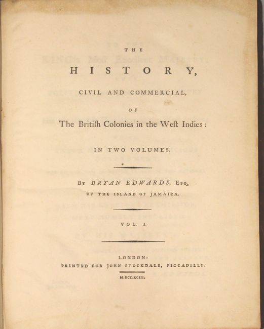
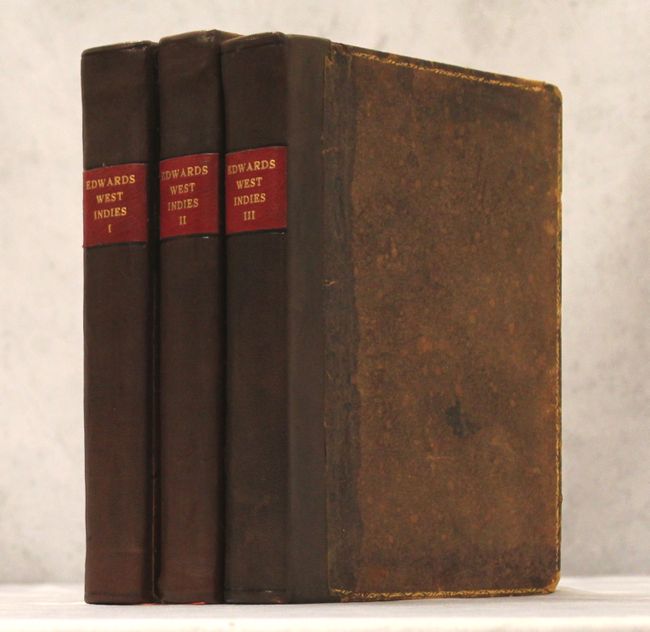
This three-volume set consists of two first edition volumes of "The History, Civil and Commercial, of the British Colonies in the West Indies..." published in 1793, along with a third volume, "An Historical Survey of the French Colony in the Island of St. Domingo," published in 1801. Edwards' work provides an excellent and complete general survey of the people, products, government, and history of the islands in the West Indies under British control. It is written from the point of view of a planter and provides information concerning the contemporary conditions, showing the state of affairs after the American war and before the abolition of the slave trade. Edwards' work was very popular, being reprinted numerous times in English, German, French and Spanish. This 3-volume set includes 3 maps:
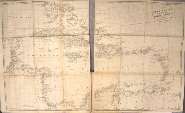
A. A New Map of the West Indies for the History of the British Colonies (43.5 x 27"). Printed on two sheets, this map shows extensive detail of the area from the southern tip of Florida through the Yucatan and Honduran coasts (here called Moskitos Shore) to the northern coast of South America. Each of the islands is depicted in minute detail. The sheets are not joined, as issued. The overall size if joined is given; each sheet is approximately 22 x 27". Condition: Scattered foxing, a few tiny splits along one fold, and faint offsetting. There is light toning along several folds and the portions of the map that are adjacent to the text pages. (B)
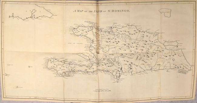
B. A Map of the Island of St. Domingo (35.7 x 17.8"). This large map of Hispaniola gives good detail of the towns, roads, and rivers throughout the island. A dashed line indicates the "Demarcation line between the French & Spaniards as fixed in 1776." Condition: Faint offsetting and a small split at a fold intersection where the map folds into the book. (B+)
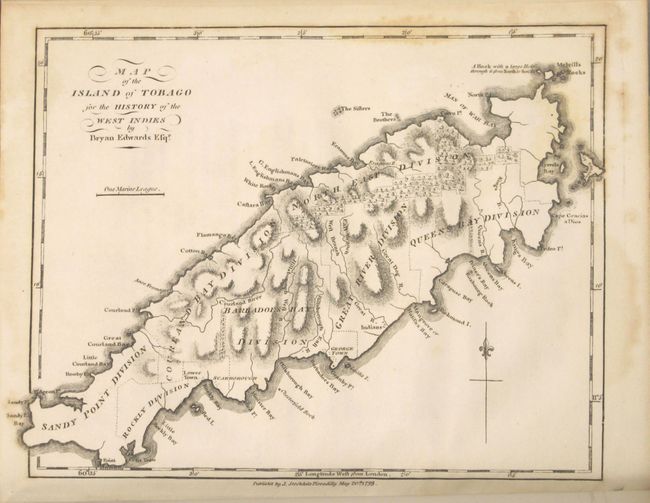
C. Map of the Island of Tobago (8.8 x 7"). A nice chart of the island showing its political divisions and coastal detail. Topography is well developed. Condition: Light scattered foxing in the border and blank margins. (B+)
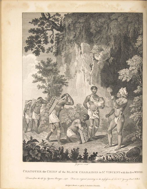
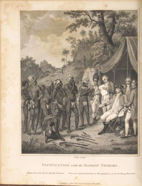
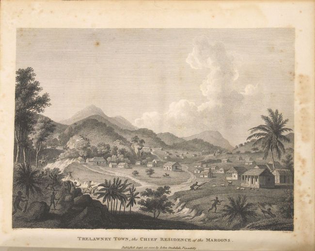
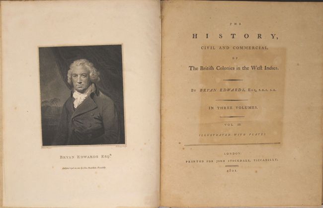
In addition to the maps are a frontispiece of the author and three plates including: "Chatoyer the Chief of the Black Charibes in St. Vincent with his five Wives," "Pacification with the Maroon Negroes," and "Trelawney Town, the Chief Residence of the Maroons." Volume 1 - 494 pp. with large folding map; Volume 2 - 502 pp. with six large folding tables at back; Volume 3 - 443 pp. with 2 maps (one large folding) and 4 plates. Original full calf covers with modern faux-leather spines with title labels on spines.
References: Sabin #21901.
Condition: B+
Maps and engravings are generally very good with occasional light scattered foxing - see above for additional details on each map. Text is clean and bright with occasional light foxing and a few pages that are lightly toned. Covers have light wear, minor abrasions, and the edges are bumped.