Subject: Atlases
Period: 1547 (published)
Publication:
Color: Black & White
Size:
8.8 x 12.4 inches
22.4 x 31.5 cm
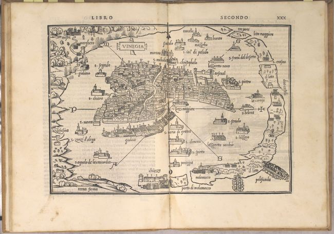
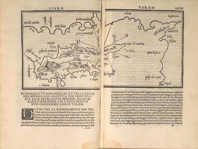
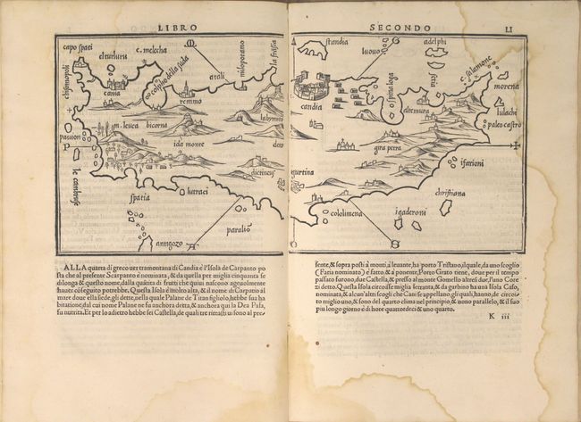
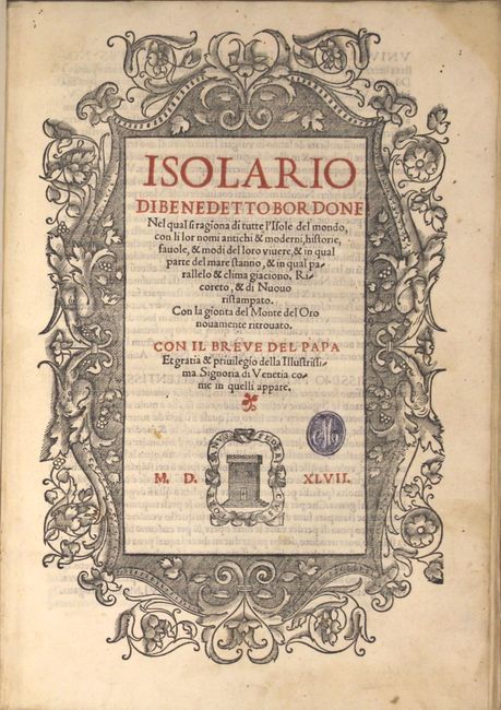
Bordone's Isolario was one of the earliest and most important works of its time. It is remarkable for being the first atlas covering the entire world not based on classical geography, but rather on contemporary information. The simplistic maps depicts islands throughout the world, with a particular emphasis on islands in the Mediterranean Sea. The book features 112 woodcut maps, including 4 double-page maps of the world, Europe, Aegean Sea, and Venice, as well as 4 smaller double-page maps of Sicily, Crete, Cyprus, and Euboea. The remaining 104 maps are either a full single-page or set within the text. Bordone was an illuminator and wood-engraver, working in Venice, when he was given permission by the Senate in 1508 to print maps of Italy and the world. None of those maps have survived and his only remaining works are the maps from his Isolario. The Isolario was first published in 1528, with subsequent editions in 1534, 1547 and 1565; this is the third edition. Several maps are of particular interest:
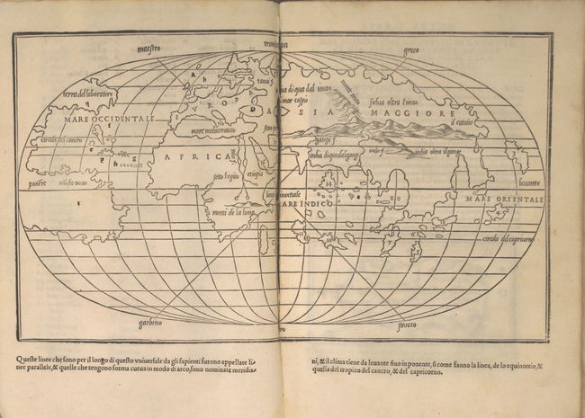
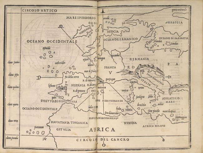
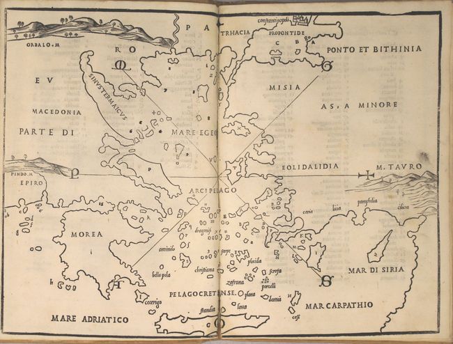
The double-page world map is one of the earliest world maps drawn on an oval projection, preceded only by that of Francesco Rosselli's map circa 1508. Bordone's map presents the world in a simple outline; its purpose being that of an index map for his Isolario (island book). Underlining the map is a system of parallels and meridians with lines criss-crossing the map representing the six wind directions, which are named in the margins. It reflects the most recent discoveries, such as the connection between North and South America and the separation of North America from Asia. South America still retains its truncated shape, the extremity of which is about 30° south latitude. There is still a remnant of the Ptolemaic land-bridge between Africa and Southeast Asia, shown as a string of large islands. However, Bordone has eliminated the Antarctic landmass shown on Rosselli's map. North America bears the inscription Terra del laboratore and South America is labeled Modo Novo. The other names on the map are in a graceful italic script with numerals referring to the island maps indexed in the Isolario.
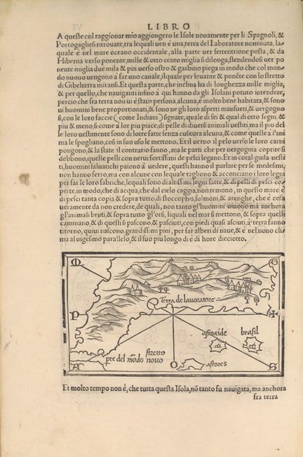
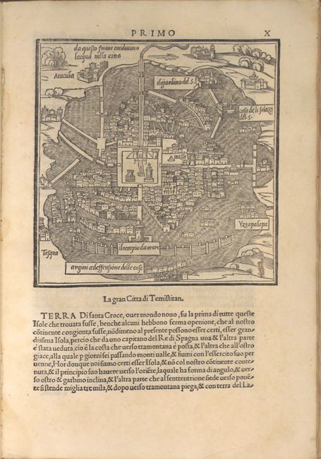
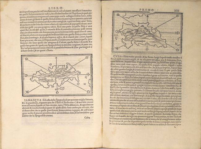
Also included is a little map that introduces a very early representation of North America, which is labeled Terra de lavortore. The Stretto pte del modo novo depicts the area corresponding to the latitude of the Caribbean. The fictitious islands of Brasil and Asmaide appear just to the north of Azores. While representing North America, the geography more closely resembles the northeast coastline of Asia; the two often being interrelated at this point in history. Other maps of North American interest include one of Mexico City, Temistitan, prior to its conquest by Cortes, as well as maps of several Caribbean islands: Hispaniola, Cuba, Jamaica, Guadeloupe, Dominica, and Martinique.
Another significant map is that of Japan, which represents the earliest known printed map devoted to Japan. Based solely on the writings of Marco Polo, the map shows a single island with an east-west orientation and the position of a major city roughly where Kyoto or Osaka is located on the main island of Honshu.
Engraved title page in red and black, 112 maps, 7 pp., 74 pp. Bound in faux-vellum with manuscript title on spine.
References: Burden #8; Shirley (BL Atlases) T.BORD-1d; Shirley (World) #59.
Condition:
The maps range in condition from fine (A+) to good (B), with occasional light toning, minor soiling, and centerfold separations in most of the double-page maps, with the world map being almost completely separated. The majority of the maps are in near fine (A) condition. There is a damp stain along the edges of four leaves that enters the image of the double-page map of Crete and three small maps. There is a previous owner's stamp on the title page. The binding is loose at bottom, with a number of the leaves detached at bottom. Covers show light soiling and sunning (B+).