Subject: Pacific Ocean
Period: 1776 (dated)
Publication: Hydrographie Francais Receuil des Cartes Marines
Color: Hand Color
Size:
32.6 x 21.8 inches
82.8 x 55.4 cm
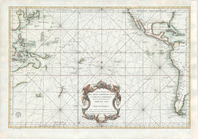
First published by Nicolas Bellin in 1742, this map was updated in 1756 and again in 1776 with the addition of the Depot de la Marine engraved stamp, which appears at bottom left. The chart focuses on the South Pacific, extending to China, Korea & Japan in the northwest and to Virginia and California in the northeast. Place names are given along the coasts, while the interiors are left almost entirely blank. This map was published after Captain Cook's second voyage and includes depictions of the western coast of New Zealand, the northern coastline of Australia, and portions of New Guinea. Tasmania is shown with a dotted conjectural coastline connecting it to Australia. The price, Prix Trente Sols, appears below the neatline at left.
References: Tooley (Australia) p. 23, #154.
Condition: B+
A clean and bright example with a dark impression. Issued folding with a few fold separations that have been professionally repaired. There is a tear that extends from the left edge of the sheet almost to the title cartouche that has been expertly and almost invisibly repaired. The right margin has been extended, and several chips and minor tears confined to the blank margins have also been professionally repaired.