Subject: Northern Africa
Period: 1790 (circa)
Publication: Travels to Discover the Source of the Nile in the Years 1768, 1769, 1770, 1771...
Color: Black & White
James Bruce was one of the earliest westerners to search for the source of the Nile. His publication greatly enhanced Europe's knowledge of the geography and ethnography of this portion of Africa. Bruce believed the Blue Nile, although smaller than the White Nile, was the Nile of the ancients and focused his explorations on this river. In November of 1770 he reached the source of the Blue Nile and claimed to have discovered its source. These maps are from the five volume account of his travels published from London in 1790, twelve years after his journey ended.
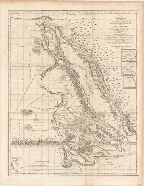
A. To the King. This Map, Containing a Chart of the Arabian Gulf with Its Egyptian, Ethiopian and Arabian Coasts, from Suez to Bab El Mandeb, a Journey Through Abyssinia to Gondar, Its Capital, from Thence to the Source of the Nile... (19.8 x 25.1"). Fascinating and intricately detailed map of the Red Sea and Nile valley. In 1768 Bruce traveled down the Red Sea as far as the straits of Bab el Mandeb and then struck inland for Gondar, the capital of Ethiopia. He rediscovered the source of the Blue Nile, which he followed to its confluence with the White Nile. Four small insets detail the harbors of Rarac, Ibraim, Sert, and Masuah. Some historical researchers believe that much of the motivation behind Bruce's epic travels in Ethiopia centered around his desire to recover sacred objects connected with Solomon's Temple and in verifying legends associating the medieval Knights Templar with old Christian churches in Ethiopia. Condition: A crisp impression on watermarked paper with faint offsetting and light toning along one fold and the edges of the sheet. (B+)
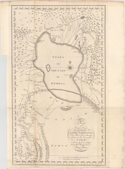
B. To My Worthy and Learned Friend the Honourable Daines Barrington This Plan of Two Attempts to Arrive at the Source of the Nile... (11.7 x 20.1"). Delineates the King's Retreat and Bruce's travels. Locates Gondar and many other small villages, mountains, cataracts, and wells. The source of the Nile River is shown at the bottom of the map. Condition: Faint offsetting and a few small spots. A short binding tear at left just touches the neatline. (B+)
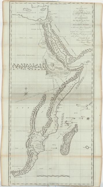
C. To the Right Revd. John Lord Bishop of Carlisle This Map Shewing the Tract of Solomons Fleet... (12.3 x 26.3"). This map, printed on bluish paper, covers the eastern coast of Africa from Cairo south the the Cape of Good Hope. It reconstructs the tracks of Solomon's fleet from the Sinai peninsula to the southern portion of the continent where numerous gold and silver mines are located. Condition: Light toning along a few fold with several fold separations confined to the blank margins. Trimmed at bottom with partial loss of neatline, and one short tear adjacent to a fold at bottom. (B)
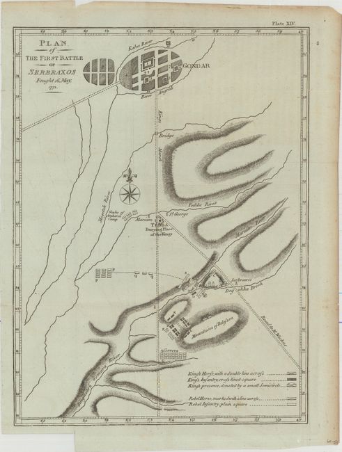
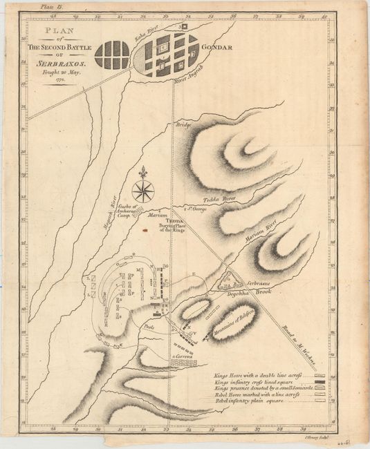
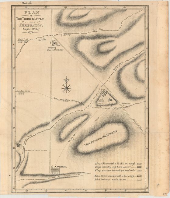
D. [Lot of 3] Plan of the First Battle of Serbraxos Fought 16 May 1772 [and] Plan of the Second Battle of Serbraxos Fought 20 May. 1772 [and] Plan of the Third Battle of Serbraxos, Fought 23d. May 1772 (8.1 x 11.0"). This set of maps is centered on Tedda and Gondar and shows the progression of troop movement over a one week period during the Battle of Serbraxos in May of 1772. Condition: Faint offsetting. The third battle sheet also has light offsetting from an opposing page of text. (B+)
References:
Condition:
Issued folding on watermarked paper. See description above for additional details.