Catalog Archive
Auction 157, Lot 667

"A Map of the Discoveries Made by Captn. Willm. Dampier in the Roebuck in 1699", Bowen, Emanuel

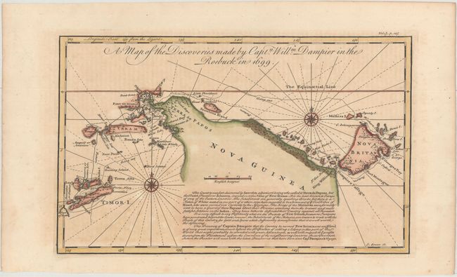
Subject: Timor, New Guinea & New Britain

Period: 1730 (circa)

Publication: Harris' Navigantium atque Itinerantium Bibliotheca

Color: Hand Color

Size:
12.6 x 7.8 inches
32 x 19.8 cm
Download High Resolution Image
(or just click on image to launch the Zoom viewer)

This copper engraved map chronicles Dampier's discovery of New Britain Island in the Bismark Sea. The map includes the Indonesian island of Timor and surrounding islands, Iraian Jaya and part of Papua New Guinea. Dampier is credited as making the first comprehensive English contact with Australia, then known as New Holland. After visiting New Holland he sailed along the northern coast of Papua New Guinea, Timor, then to New Britain and finally westward through some of the East Indies, stopping in Batavia (Jakarta) on Java.

References: Shirley (BL Atlases) G.HARR-1a #4.

Condition: B+

A sharp impression on watermarked paper with light offsetting from an opposing page of text and minor toning.

Estimate: $300 - $400

Sold for: $220

Closed on 5/4/2016

Archived