Subject: Japan
Period: 1881 (circa)
Publication:
Color: Hand Color
Size:
13.9 x 62.6 inches
35.3 x 159 cm
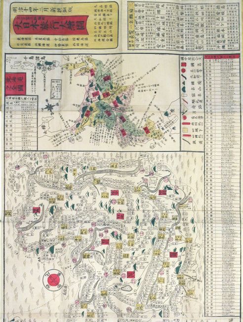
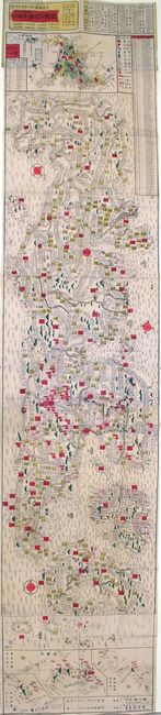
This long woodblock map is a conceptual, stylistic map of Japan, produced during the Meiji period (1868 - 1912). The Meiji period is so named for the 45-year reign of Emperor Meiji and is the period associated with Japan's modernization and rise to world power status. The name literally means "Period of Enlightened Rule." It was designed for the use of travelers going from town to town by way of roads and railroads and displays cities, towns, stations, rivers, and ferry routes between islands. Includes inset maps of Hokkaido and Ryukyu islands. All names and descriptions are in Japanese characters. Printed on four joined sheets and folds into yellow self wrappers (3.7 x 6.6").
References:
Condition: A
Original color with minor soiling and a few tiny splits at fold intersections. Covers are soiled with some chips and abrasions.