Subject: Ancient World
Period: 1682 (published)
Publication:
Color: Black & White
Size:
8.7 x 13.3 inches
22.1 x 33.8 cm
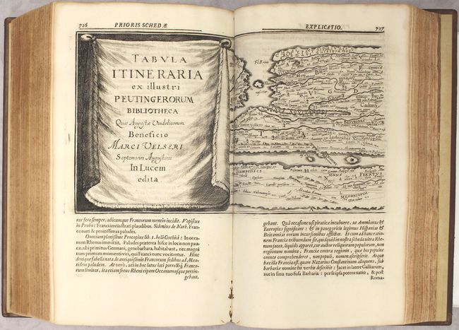
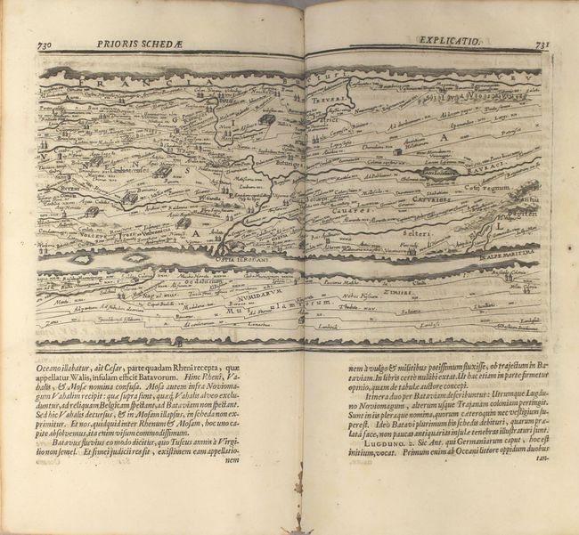
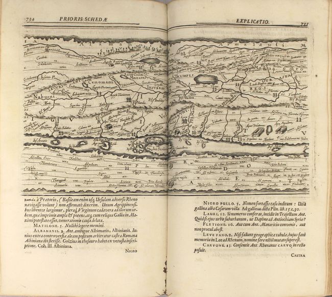
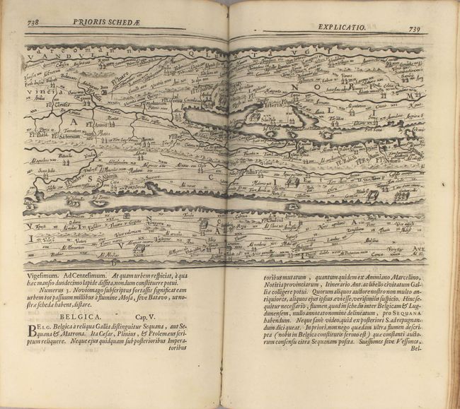
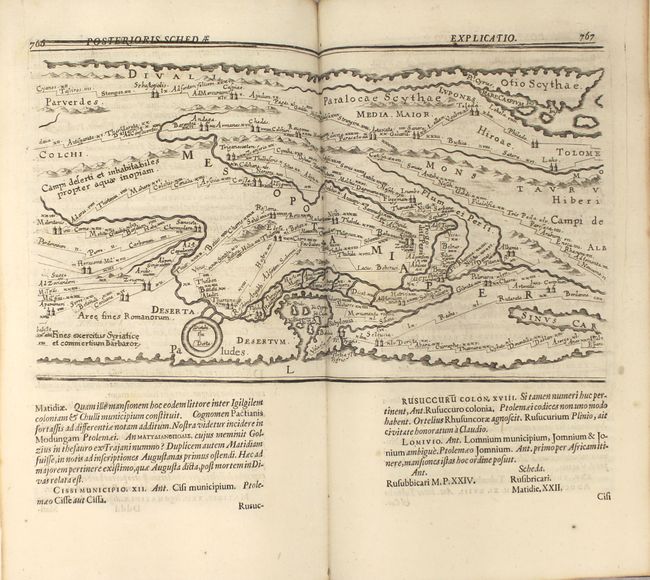
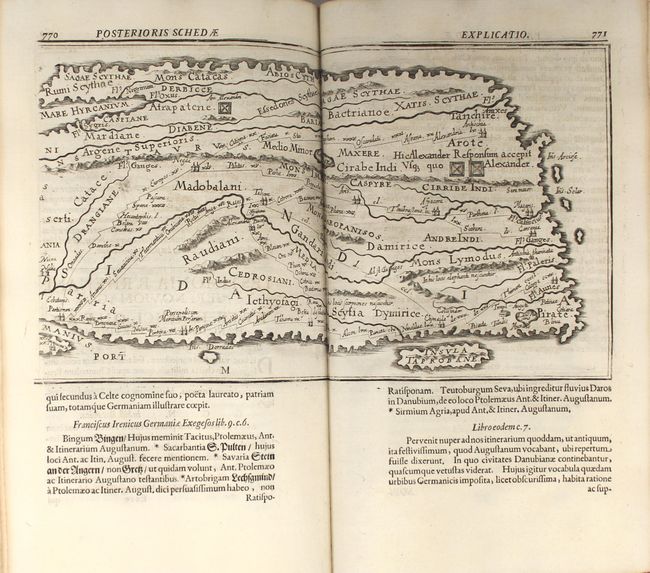
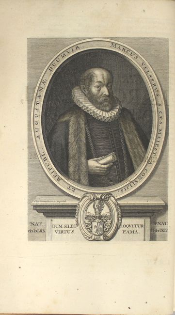
This impressive long map is the famous Peutinger Table, or a Roman road map of the world. The original parchment document was found in a library in Augsburg by Konrad Celtes, who bequeathed it to Konrad Peutinger in 1508. The map later went to Peutinger's relative, Marc Welser, who was the first to publish a copy of it in 1591 at Aldus Manutius in Venice. This map, based on the original manuscript, was popularized by Ortelius in 1598 and became an important part of his great historical atlas. Ortelius divided the map into 8 sections, printed on four sheets. In 1652, Jan Jansson engraved a new version nearly identical to that of Ortelius, which was published in his Atlas Novus as well as several other publications. The map was again re-engraved in 12 sections for a 1682 edition of Marc Welser's complete works. This decorative strip map depicts the imperial roads and posts within the Roman Empire throughout Europe, North Africa and Asia as far as Toprobana (Sri Lanka).
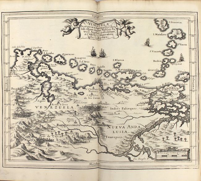
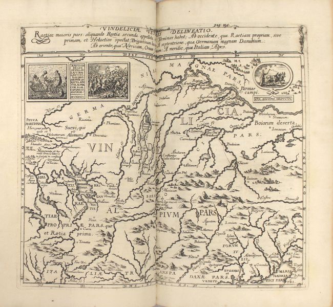
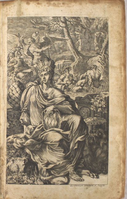
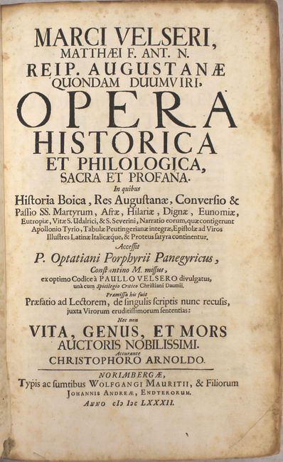
This example, printed on 12 sheets, was published by Wolfgang Mauritii and Johannes Andreae in Nuremburg in Opera Historica et Philologica, the complete works of Marc Welser. This edition includes a lovely allegorical frontispiece engraved by Georg Christoph Eimmart, a portrait of Marc Welser, two double-page maps, and numerous engravings throughout the text. The two double-page maps are:
Venezuela Provincia in America Occidentali is based on the cartography of Hessel Gerritsz and extends east to the mouth of the Orinoco River. Stylistically this map is quite different, with three-dimensional mountains, sailing ships, and the title held aloft by putti. The second map, Vindeliciae Veteris Delineatio depicts central Europe and is filled with ancient place names. The map gives particular focus to the river systems, extending from the Danube River in the north to the Gulf of Venice in the south. The map includes small vignettes of Roman sea and land battles from 739 A.D.
9 ll., 68 pp., 20 ll., 908 pp., 13 ll., 32 ll. Small folio, hardbound in full leather with raised bands and red leather title label on spine.
References: Shirley #516.
Condition: A
The maps are crisp, clean and bright, with minor worming along the centerfold in the bottom blank margin of several of the Peutinger Table maps. The text has occasional light foxing with toning along the edges and minor soiling. The binding is tight and the covers show minor wear with a few small abrasions. An overall attractive example.