Catalog Archive
Auction 157, Lot 460

"Oxoniensis Comitatus Vulgo Oxfordshyre qui pars olim Dobunorum", Saxton/Hole

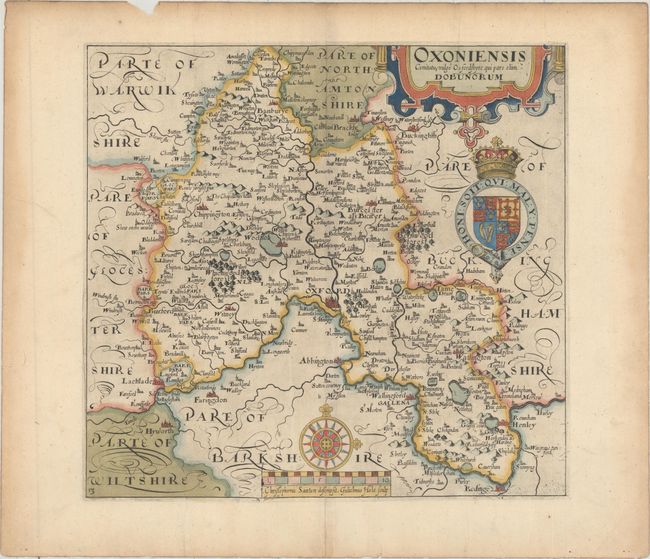
Subject: Southern England

Period: 1637 (published)

Publication: Camden's Britannia

Color: Hand Color

Size:
11.4 x 10.7 inches
29 x 27.2 cm
Download High Resolution Image
(or just click on image to launch the Zoom viewer)

This handsome map is one of the first maps published of the county of Oxfordshire, and is centered on the famed city of Oxford. There is good detail of towns, rivers, lakes, forests, and mountains. The map is adorned with a strapwork cartouche, the royal coat of arms, and a large compass rose. Saxton and Hole's imprint appears below the distance scale. Published in the 1637 edition of Camden's Britannia, with the addition of a plate number on the map.

References: Shirley (BL Atlases) T.CAMD-1e.

Condition: A

A crisp impression on watermarked paper with attractive color, a chip in top blank margin, and light toning along the edges of the sheet.

Estimate: $240 - $300

Sold for: $190

Closed on 5/4/2016

Archived