Subject: Arctic Ocean & Canada
Period: 1854-60 (circa)
Publication:
Color:
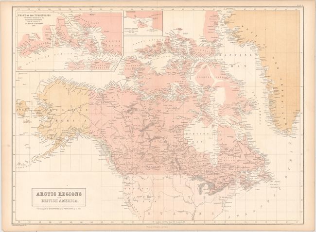
A. Arctic Regions and British America, by A. and C. Black, from Black's General Atlas of the World, published 1854, printed color (22.1 x 16.4"). Detailed map of Canada, Alaska and Greenland with emphasis in the Arctic explorations, which are marked. Insets: "Chart of the Territories Discovered & Examined by the Searching Expeditions under the Command of Cap. Austin & Cap. Penny 1851" and "Beechey Island Site of Sir J. Franklin's Winter Quarters 1845 - 1846". Condition: Light toning along the edges of the sheet.
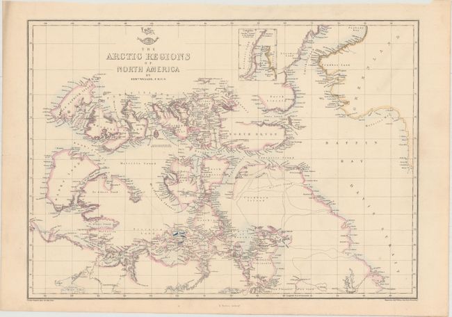
B. The Arctic Regions of North America, by Edward Weller, from Weekly Dispatch Atlas, circa 1860, hand color (16.6 x 11.9"). This map of the northern regions of Canada still includes a number of partial and conjectural coastlines. There are notations regarding various expeditions throughout. Includes a small inset of the "Continuation of Smiths Sound in the Northward." Condition: Soiling in top left corner of sheet, away from image.
References:
Condition: A
See description above.