Subject: World
Period: 1798 (circa)
Publication: Encyclopaedia Britannica
Color: Black & White
Size:
13.8 x 7.6 inches
35.1 x 19.3 cm
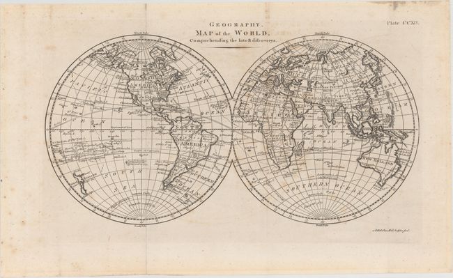
This elegantly engraved double-hemisphere world map shows the track of Captain Cook's third and final voyage. It also includes various notes on exploration, such as several sightings of ice in the region of Antarctica and Is. said to have been discovered by the Spaniards in 1773 between the Pitcairn Islands and Easter Island. In North America, the land west of Mississippi is identified as Louisiana and New Albion. Baja California is named California. Tasmania (Diemens Land) is attached to the rest of Australia. A number of islands are identified in the South Pacific.
References:
Condition: B+
A nice impression issued folding on watermarked paper with light scattered foxing.