Subject: Washington
Period: 1853-54 (dated)
Publication:
Color:
The Office of Coast Survey is the oldest U.S. scientific organization, dating from 1807 when Congress directed that a "survey of the coast" be carried out. By 1836, it was called the U.S. Coast Survey and in 1878, the name was changed to the U.S. Coast and Geodetic Survey. Today the Office of Coast Survey is a division of the National Oceanic and Atmospheric Administration NOAA.
The survey teams, composed of civilians as well as Army and Naval officers, charted the nation's waterways and produced a wide array of reports, survey charts, hydrographic studies of tides and currents, astronomical studies and observations, and coastal pilots. These charts are an important record of the changing nature of the nation's coastlines. In additional to coastal charts, the U.S. Coast and Geodetic Survey produced land sketches, Civil War battle maps, and the early aeronautical charts.
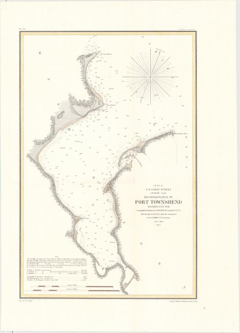
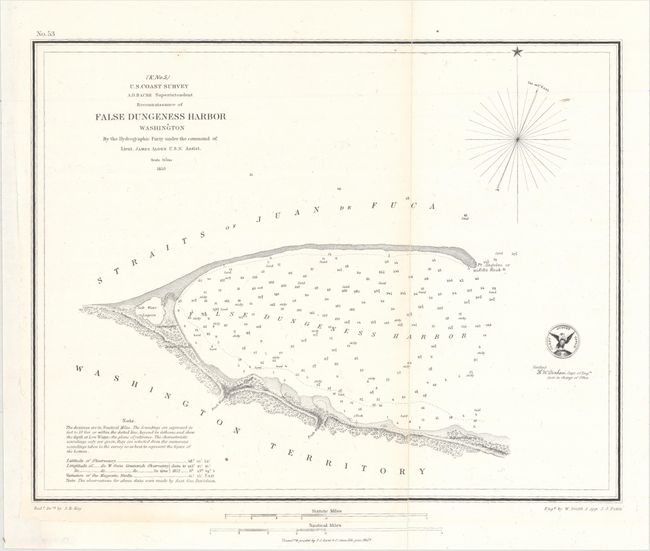
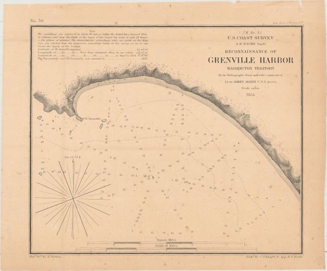
This lot includes three highly detailed charts from the U.S. Coast Survey depicting the Washington Territory. They feature fine coastal detail and navigational information such as depth soundings, bottom types, and hazards. The first shows Port Townsend on the northeastern tip of the Olympic Peninsula. It locates a U.S. Custom House in a snug little bay. The second sheet focuses on Port Angeles Harbor, here called False Dungeness Harbor, near the Strait of Juan de Fuca. A salt water lagoon and Ediz Hook, the glacial moraine that spans from the northern shore of the Olympic Peninsula into the Strait of Juan de Fuca, are identified. The final sheet covers the headland of Point Grenville.
A. Reconnaissance of Port Townshend Washington Ter., dated 1854, hand color (10.3 x 15.6"). Condition: A nice impression issued folding and now flattened and backed with tissue to repair a short fold separation at center. (A)
B. Reconnaissance of False Dungeness Harbor Washington, dated 1853, black & white (12.3 x 9.7"). Condition: A crisp impression, backed with tissue to repair a split running the length of the map's single fold. The chart has been remargined at left and bottom, with a nautical miles scale and imprint from another map along the bottom. (B)
C. Reconnaissance of Grenville Harbor Washington Territory, dated 1854, black & white (8.3 x 6.9"). Condition: A dark impression on a moderately toned sheet with light scattered foxing and binding holes in the top blank margin. (B)
References:
Condition:
See description above.