Subject: Pennsylvania
Period: 1834 (published)
Publication: American State Papers, Vol. 1
Color: Black & White
Size:
26 x 17.7 inches
66 x 45 cm
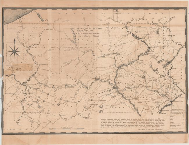
This is a reduced copy of Howell's map of 1792, which was one of the most important maps of Pennsylvania to appear in the eighteenth century. It shows the entire state with remarkable detail and includes roads, canals, donation lands, counties, townships and topography with an emphasis on transportation. Most settlement is along the Delaware River and the southeastern portion, as well as around Pittsburgh. A dedication at upper center states "to the Legislature and the Governor of Pennsylvania this map is respectfully inscribed by Reading Howell." The title above is contained in the copyright near the bottom of the map. The map was originally issued in An Historical Account of the Rise, Progress and Present State of the Canal Navigation, c. 1795 and was reproduced here for the American State Papers.
References: cf. Wheat & Brun #443; cf. Phillips (M) pp. 678-79.
Condition: B
Issued folding with light to moderate offsetting and toning. There is a 4" binding tear at left that has been repaired on verso with tape which has left a stain on recto below the compass rose. Narrow side margins and trimmed to the neatline at lower left.