Subject: Oregon
Period: 1859 (dated)
Publication: Senate Doc. 2, 36th Congress, 1st Session
Color: Black & White
Size:
22.1 x 17.4 inches
56.1 x 44.2 cm
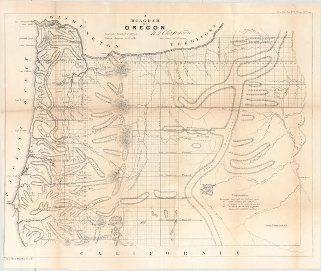
This detailed map of the entire state was created at the land office in Salem. It shows topographical information in hachure, watershed, and the progress of surveying. Eugene City, Oregon City, Port Orford, Roseburg, and many more are located. Trails and roads shown include the , Trail to Powder River, Wallen's Route, Mix's Trail, and Road to Salt Lake. Just across the Snake River is Fort Boisee. The map is signed in the plate W. W. Chapman, Surveyor General of Oregon. Published in August 1859, less than six months after Oregon obtained statehood.
References:
Condition: B+
Issued folding with light toning along the folds and a number of short fold separations that have been closed with archival tape on verso. The margin has been trimmed to the border at bottom left.