Subject: World
Period: 1743 (published)
Publication: Pufendorf's L'Histoire Generale et Political, de l'Universe
Color: Black & White
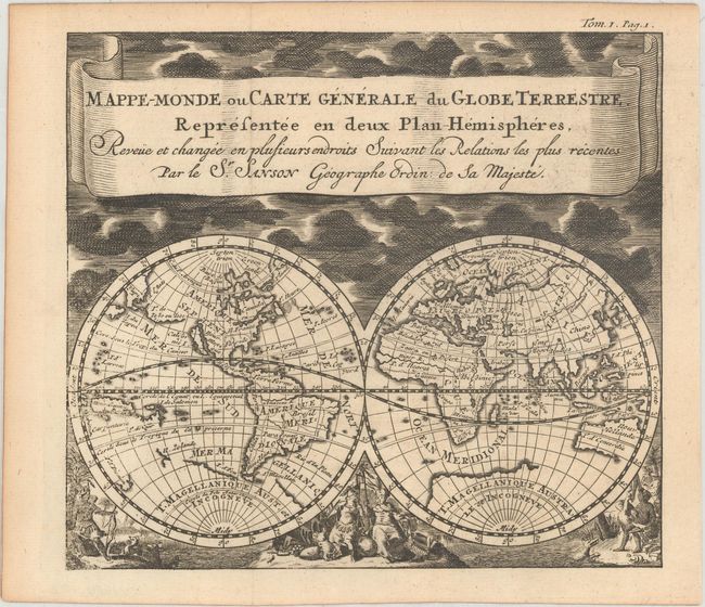
A. Mappe-Monde ou Carte Generale du Globe Terrestre Representee en Deux Plan-Hemispheres... (6.5 x 5.8"). This uncommon double hemisphere map is beautifully decorated with clouds at the top and allegorical representations of the continents along the bottom. The graceful banner-style title cartouche attributes the geography to Sanson. California is shown as an island with an incomplete coastline in the Pacific Northwest, which was yet to be explored and charted. The Great Lakes do not yet appear but there is a large St. Lawrence River. T. de Iesso stretches between Asia and North America. In the southern hemisphere, there is a bit of Il. Zelande and almost connecting to the large T. Magellanique Aust. et Incongneve, and Australia (Nouv. Hollande) is only partly mapped. This is a smaller version of a map by Jan Luyts (Shirley #553), published in Baron Pufendorf's "L'Histoire Generale et Political, de l'Universe" in 1743. Condition: A dark impression with light toning along sheet edges. (A)
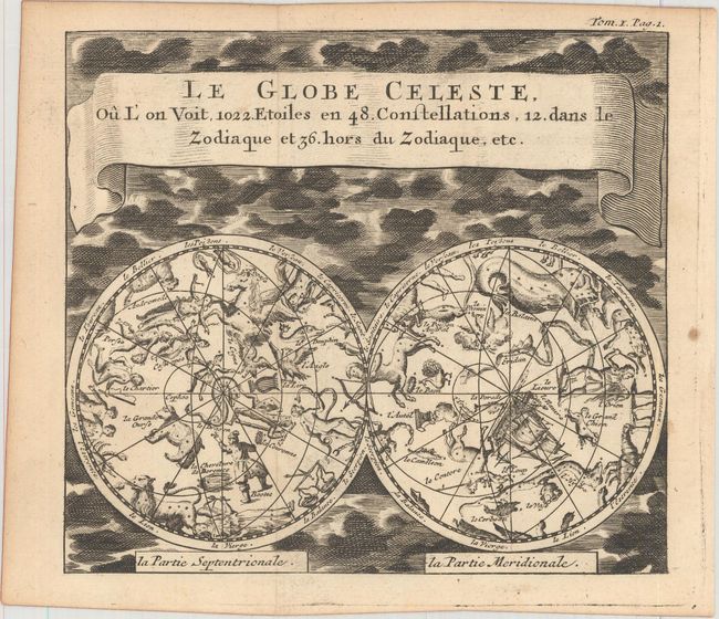
B. Le Globe Celeste, ou l' on voit, 1022 Etoiles en 48 Constellations, 12 dans le Zodiaque et 36 Hors du Zodiaque, etc. (6.5 x 5.8"). This charming double hemisphere celestial map includes allegorical representations of the constellations. The night sky in both the northern and southern Hemispheres is depicted with 1022 stars forming 48 constellations in their human, animal, and object forms. Condition: There is one faint spot in the right blank margin, else fine. (A)
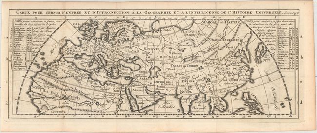
C. Carte pour Servir d'Entree et d'Introduction a la Geographie et a l'Intelligence de l'Histoire Universele (14.6 x 5.4"). This map of the Ancient World spans from the British Isles east to Japan and south to central Africa. Tables at left and right key 32 locations to the map. Condition: Light offsetting. (B+)
References: Shirley (BL Atlases) G.PUF-2b #1, #2, & #6; Shirley #551 (Corrigenda and Addenda).
Condition:
Issued folding. See description above for details.