Subject: Long Island, Staten Island, Southern New York
Period: 1842 (dated)
Publication:
Color: Hand Color
Size:
50.9 x 22.4 inches
129.3 x 56.9 cm
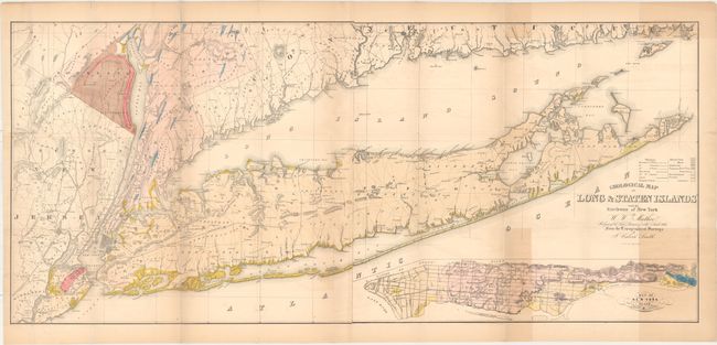
This large map is undoubtedly one of the best and most detailed depictions of Long Island. Although labeled a geological map, it provides a much more comprehensive view of the area than that label suggests with its hand coloring, detailing of roads, villages, communities, and other political information. It covers Long Island and the rest of southern New York state, as well as Westchester and Rockland counties and northeastern New Jersey. At bottom right is a large inset of "New York Island" detailing the major streets and topography. The colorful sheet is further embellished with fancy lettering in the title. A large map on two sheets joined, as issued. From the topographical surveys of J. Calvin Smith, lithographed by Endicott.
References:
Condition: B
Issued folding with light uneven toning, faint offsetting, and a couple edge tears and tiny splits at fold intersections that have been closed on verso with archival materials.