Subject: Western Nevada
Period: 1881 (published)
Publication:
Color: Printed Color
Size:
18.2 x 27.4 inches
46.2 x 69.6 cm
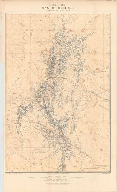
This remarkably detailed topographical map is updated from Capt. Wheeler's "Outline Map of Washoe District Nev. Showing Comstock Lode" from his "Surveys West of the 100th Meridian" showing a slightly larger area to account for the increased number of claims. It shows the gold and silver operations in the vicinity of Virginia City. It is difficult to overstate the number of claims shown -- perhaps as many as 120 in a patchwork mosaic cover the region so completely it is difficult to see place names. Scores of mills including Sherman, French's, Humphreys, Nevada and many more are identified. The Sutro Tunnel is detailed with the tunnel entrance located. Hundreds of settlements and villages, roads and trails are presented. The map attests to the manic mining activities of the day.
References:
Condition: B+
A clean example with faint toning and a few tiny splits at fold intersections. There is a 3.5" binding tear at left that has been closed on verso with archival material.