Catalog Archive
Auction 157, Lot 297

"Administrative Map of Glacier National Park Montana", U.S. Geological Survey (USGS)

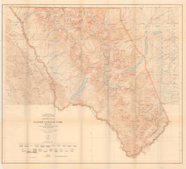
Subject: Glacier National Park, Montana

Period: 1911 (dated)

Publication:

Color: Printed Color

Size:
32.1 x 28.5 inches
81.5 x 72.4 cm
Download High Resolution Image
(or just click on image to launch the Zoom viewer)

This map covers Glacier National Park in Montana, along the United States-Canada border. Intricate contour lines provide excellent topographical detail. Individual mountains, streams, lakes, rivers, roads, railroads, trails, benchmarks, and more are located. The park is bordered by the Blackfeet National Forest in the west and the Blackfeet Indian Reservation in the east. Based on the surveys of Chief Geographer R.B. Marshall from 1900-04 and 1907-10.

References:

Condition: A

Minor toning with a few tiny tears at some of the fold intersections, a tiny edge tear that just enters the neatline at left, and a small chip in the bottom left blank margin.

Estimate: $275 - $350

Unsold

Closed on 5/4/2016

Archived