Catalog Archive
Auction 157, Lot 283

"Karte von Hawaii mit Benutzung der Daten...", Petermann, Augustus Herman
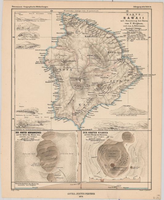
Subject: Hawaii

Period: 1876 (dated)

Publication: Geographische Mittheilungen

Color: Hand Color

Size:
7.8 x 9.8 inches
19.8 x 24.9 cm
Download High Resolution Image
(or just click on image to launch the Zoom viewer)

This highly detailed German map depicts the rugged topography and volcanoes on the Big Island. It is surrounded by eight small profile views with insets of Mauna Loa and Kiluea at bottom.

Dr. Augustus Herman Petermann's Geographische Mittheilungen was the oldest German trade magazine dedicated to geography. First published in 1855, the magazine covered many of the important discoveries of the 19th and 20th century until its end in 1937. Published by Justus Perthes in Gotha.

References: Phillips (Maps) p. 317.

Condition: A

Original color with just a hint of toning, otherwise fine.

Estimate: $140 - $170

Sold for: $100

Closed on 5/4/2016

Archived