Subject: Southwestern United States
Period: 1907-17 (dated)
Publication:
Color: Printed Color
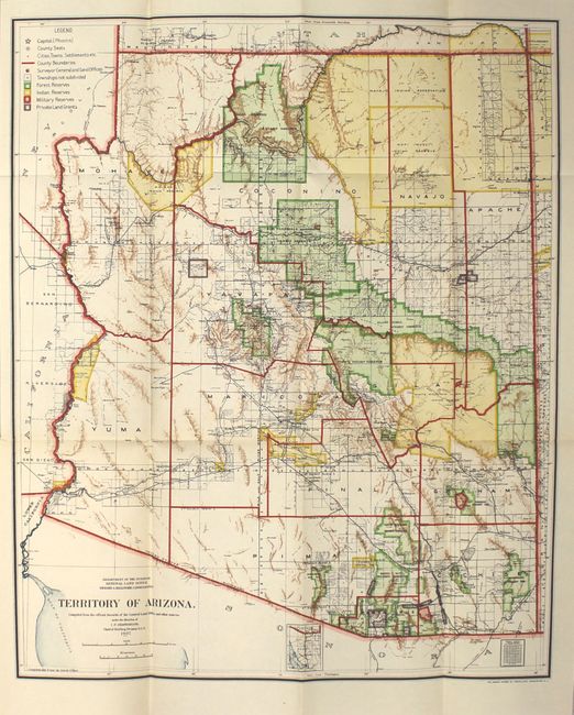
A. Territory of Arizona, by General Land Office, dated 1907 (16.8 x 20.3"). A colorful map with great detail issued just five years before Arizona attained statehood. The map clearly shows Indian Reservations, Military Reservations (Fort Apache, Fort Grant, Fort Huachuca and Fort Whipple) and Forest Reserves via different colors. A huge Grand Canyon Forest Reserve is shown and the new Petrified Forest National Monument (established in 1906) is located east of Holbrook. Details include watershed, mountains, railroads, wagon roads, private claims, unsurveyed townships, etc. The map is still bound into the 38-page "Report of the Governor of Arizona" with gray paper wrappers (5.8 x 9.0"). Condition: A clean and colorful example with a short binding tear at left that has been closed on verso with archival material. Report is very good with a "discarded" stamp on front cover.
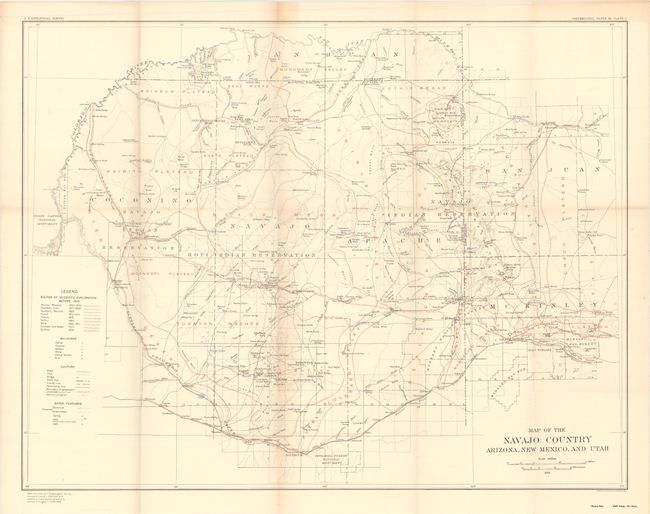
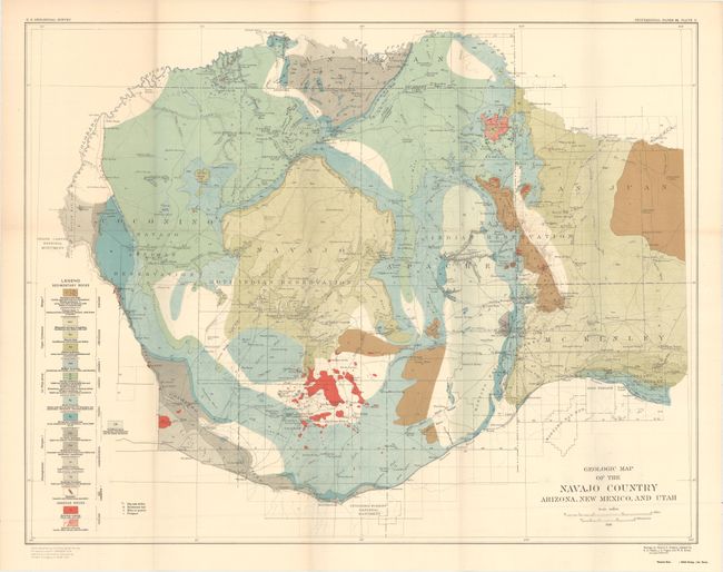
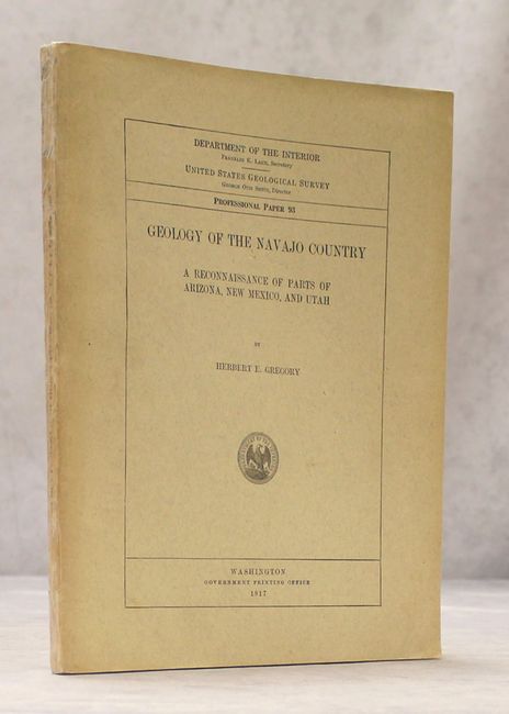
B. Geology of the Navajo Country - A Reconnaissance of Parts of Arizona, New Mexico, and Utah, by United States Geological Survey, published 1917 (9.1 x 11.6"). This is Herbert Gregory's 161-page geological report on the region that contains the folding Map of the Navajo Country Arizona, New Mexico, and Utah (15 x 17.7"). The map depicts the Navajo Indian Reservation in northeastern Arizona, northwestern New Mexico, and southeastern Utah. It displays roads. streams, trails, bridges, mines, public buildings. etc. as well as the routes of the scientific explorations before 1909. The report also contains a Geologic Map of the Navajo Country... which has the same base map and is augmented by 16 different geological types. In addition to the maps, there is a plate of geologic sections and numerous full-page photographic plates. Condition: Folding maps are near fine with just a bit of light toning. Text and plates are excellent while the back pocket housing the folding maps has essentially perished. Paper wrappers are very good with small chips to the spine that have been reinforced with archival tape.
References:
Condition: A
See description above.