Subject: Western United States
Period: 1880-82 (dated)
Publication:
Color: Hand Color
Size:
21.9 x 14.4 inches
55.6 x 36.6 cm
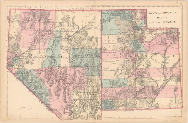
A. County and Township Map of Utah and Nevada, dated 1880. Large and detailed map of Utah and Nevada. There is excellent detail of mountains, roads, villages and towns, railroads, and the extent of completed surveys. Mountains are shown in hachure. This early edition of the map does not include the inset of southern Nevada.
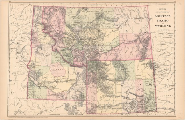
B. County and Township Map Montana Idaho and Wyoming, dated 1882. This is a handsome regional map with nice topographical detail. The map illustrates the sections than have been surveyed in each state and locates settlements, Indian reservations, railroads, mining communities, and forts. Virginia City is the capital of Montana. All three states have early county development.
References:
Condition: A
Original color with minor toning along the edges of the sheets and a few tiny chips and tears confined to the blank margins.