Subject: Western United States
Period: 1880-1904 (circa)
Publication:
Color:
This lot of five maps shows the growth of the Denver & Rio Grande railway system over a 24 year period (1880-1904). The maps include:
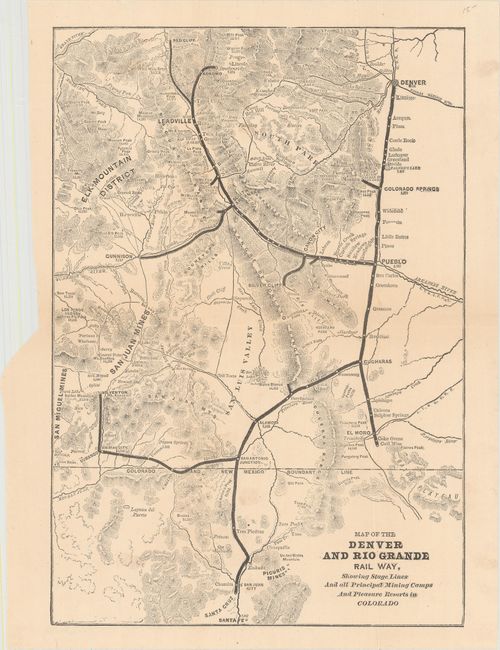
A. Map of the Denver and Rio Grande Rail Way, Showing Stage Lines and All Principal Mining Camps and Pleasure Resorts in Colorado, by George A. Crofutt, from Crofutt's Guide of Colorado, circa 1880, black & white (9.4 x 13.6"). Covers the region from Denver south to Santa Fe, including lines to Silverton, Gunnison and Leadville. Condition: Light toning and a short fold separation closed on verso with archival tape. (B+)
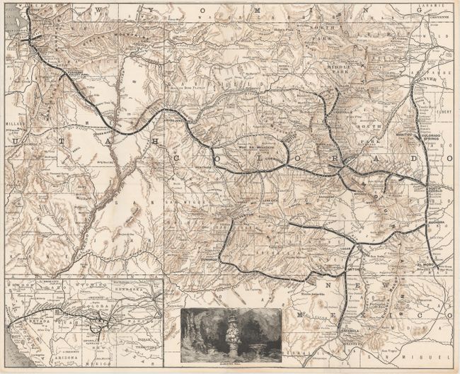
B. [Untitled - Denver and Rio Grande System], by Rand McNally & Co., circa 1885, printed color (17.3 x 14.2"). This untitled map extends farther west to include Grand Junction, Green River and Salt Lake City. Topography is graphically depicted via hachure. Includes an inset map at bottom extending to the Pacific Ocean, and there is a small engraving at bottom of Alabaster Hall, located in the Manitou Grand Caverns. Condition: A clean and bright example. (A+)
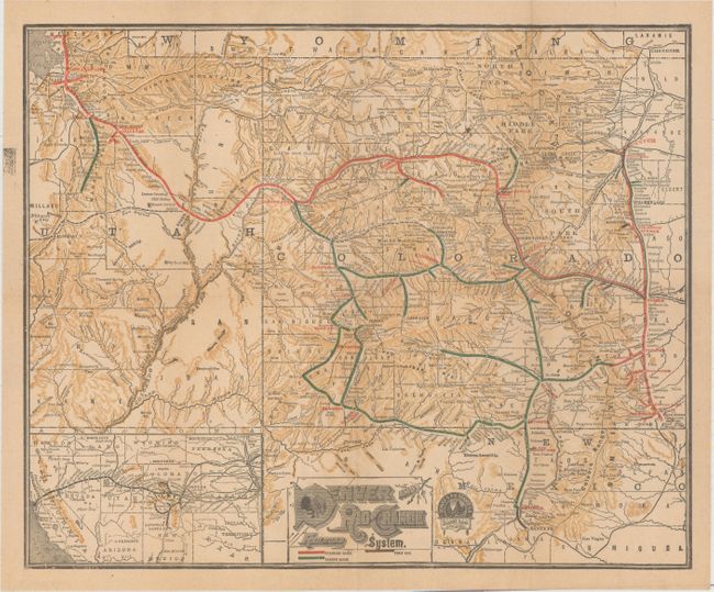
C. Denver and Rio Grande Railroad System, by Rand McNally & Co., circa 1891, printed color (17.5 x 14.4"). Essentially the same map as "B" above, but shows completed lines from Leadville to Grand Junction, Montrose to Ouray, and several other spoke lines. The map has also been updated to reflect which lines are standard gauge, narrow gauge, and three rail. Condition: Pleasant light toning. (A)
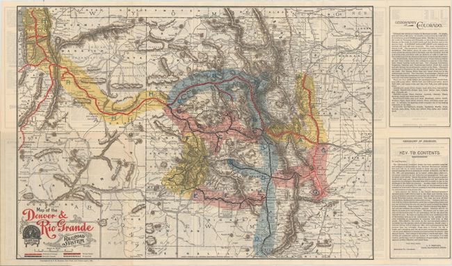
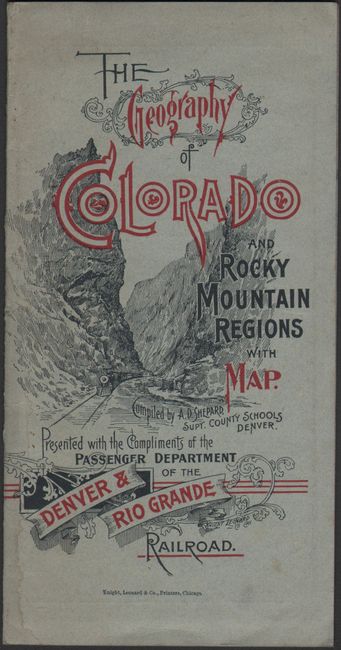
D. Map of the Denver & Rio Grande Railroad System, by S.K. Hooper, dated 1895, printed color (19.2 x 13.6"). Updated to include further expansion of the rail lines primarily in the mining districts. This edition of the map is color-coded with text on verso describing these regions. Folds into paper wrappers "The Geography of Colorado and Rocky Mountain Regions with Map" (3.7 x 7.4") and was compiled by A.D. Shepard, Superintendent of County Schools in Denver. The brochure was prepared for the annual meeting of the National Educational Association in Denver that year. Condition: A clean and bright example with light text show-through from verso. (A)
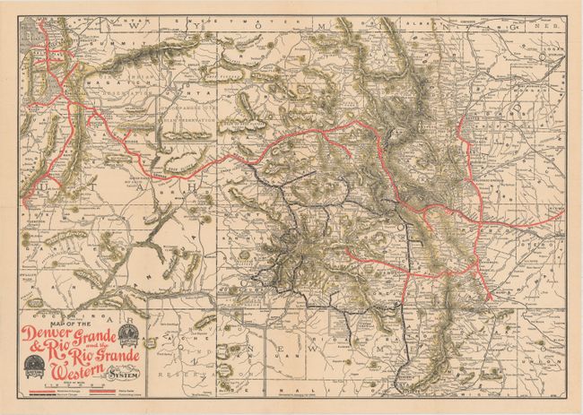
E. Map of the Denver & Rio Grande and the Rio Grande Western, by Rand McNally & Co., dated 1904, printed color (19.2 x 13.5"). Updated version of "D" above with only a few additional spokes and connections. Condition: A few tiny splits at fold intersections, otherwise fine. (A)
References:
Condition:
Issued folding. See description above.