Subject: Western United States
Period: 1842 (circa)
Publication:
Color: Black & White
Size:
13.5 x 6.3 inches
34.3 x 16 cm
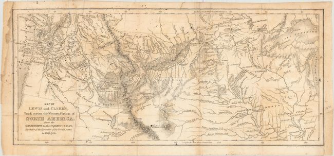
This is a reduced version of the original Lewis & Clark map published in 1814, covering the northern two-thirds of the United States from the Great Lakes to the Pacific Ocean. The various routes of Lewis and Clark are shown along with details of forts, rivers, mountains and Indian tribes. There are some interesting notes as well, such as "Here the different Tribes meet in Friendship & collect Stone for Pipes." The map was completed by W.G. Evans and revised by Archibald M'Vickar in 1842.
References:
Condition: B
Issued folding and now flattened and backed with tissue. There is light offsetting and some excess ink spots in the top left portion of the image. A binding trim at lower right and a chip in the top left blank margin have been replaced with old paper.