Subject: South Central United States
Period: 1860-74 (dated)
Publication:
Color: Hand Color
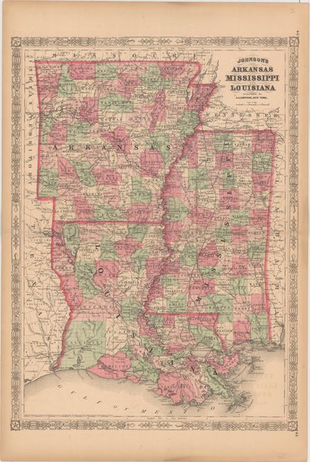
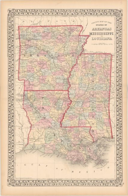
The first two maps depict the changes in both state and county boundaries over an 8-year period. Both state maps show good detail of county boundaries, numerous place names, roads and railroads and are surrounded by decorative borders.
A. Johnson's Arkansas Mississippi and Louisiana, by A.J. Johnson, dated 1866 (16.9 x 23.2"). A very detailed map of Arkansas, Louisiana and Mississippi published at the end of the Civil War. County configuration of Arkansas is current to 1859, prior to the creation of Cross and Woodruff counties in 1862.
B. County Map of the States of Arkansas Mississippi and Louisiana, by Samuel Augustus Mitchell Jr., dated 1874 (13.8 x 21.0"). This map shows county configurations current to 1871, prior to the creation of Pearl County in Mississippi and Baxter and Howard Counties in Arkansas.
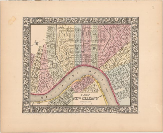
C. Plan of New Orleans, by Samuel Augustus Mitchell Jr., dated 1860 (11.0 x 9.3"). The heart of the city is depicted in this plan: Bourbon and Canal Streets, the Mississippi River, and the Mexican Gulf Railroad are clearly shown. Surrounded by a decorative floral border.
References:
Condition: B+
Hand color with faint to light toning and a few small spots.