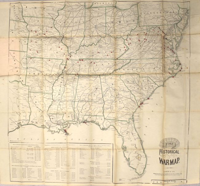
Subject: Southern United States, Civil War
Period: 1862 (dated)
Publication:
Color: Hand Color
Size:
24.4 x 24.4 inches
62 x 62 cm
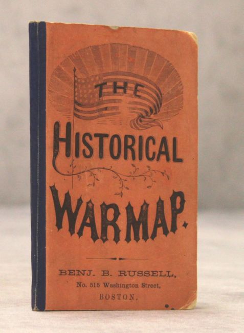
This is Asher's superb and scarce pocket map of the region involved in the Civil War. This map shows actions up to August 9th, 1862 in Culpepper, Virginia. The map covers the general area of the war showing towns, railroads, waterways and forts. State boundaries are colored green and battle sites are located with red overprinting. Population statistics and "Date of Admission and Secession of the Southern States" is shown at bottom. Folds into orange paper covers with a 24-page "Rebellion Record" containing a fascinating contemporary view of the war including four small maps depicting the Battle of Bull Run, Fort Donelson, Shiloh Battle Ground, and Richmond, Va. and Vicinity.
References: Stephenson #21.1.
Condition: B
Issued folding with light toning along the folds, several short separations closed on verso with archival material, and a few spots of foxing. Covers are very good.