Catalog Archive
Auction 157, Lot 204

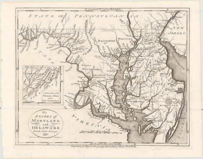
"The States of Maryland and Delaware from the Latest Surveys", Payne, John
Subject: Maryland, Delaware

Period: 1799 (dated)

Publication: A New and Complete Universal Geography

Color: Black & White

Size:
9.2 x 7.3 inches
23.4 x 18.5 cm
Download High Resolution Image
(or just click on image to launch the Zoom viewer)

This map was drawn by Anderson and engraved by John Scoles, showing all of Maryland and Delaware. The inset, Continuation of the Potowmac River from Fort Cumberland, extends the area covered west. A circular cartouche contains the title, and the distance scale is in American Miles. The boundary between Maryland and Virginia is incorrectly shown to run down the middle of the Potomac River, instead of along the Virginia shoreline, as was agreed in the Compact of 1785. This map was derived from the Samuel Lewis map of 1795 and engraved by E. Low.

References: Wheat & Brun #518.

Condition: A

A crisp impression on a clean sheet.

Estimate: $275 - $350

Sold for: $160

Closed on 5/4/2016

Archived