Subject: Red Sea & Egypt
Period: 1765 (dated)
Publication:
Color: Black & White
This pair of maps were each printed on two joined sheets and published by d'Anville.
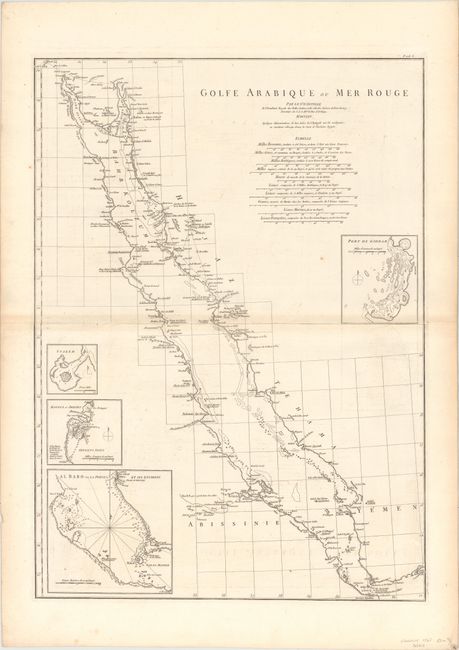
A. Golfe Arabique ou Mer Rouge, (19.0 x 26.4"). Very uncommon chart of the Red Sea with detail of the coastal settlements, islands, shoals and caravan routes. Four insets show Jeddah near Mecca (Port de Giddah), Suakin in Sudan (Suakem), Massawa and Arkiko in Eritrea (Matzua et Arkiko), and the Mandeb Strait (Al Babo).
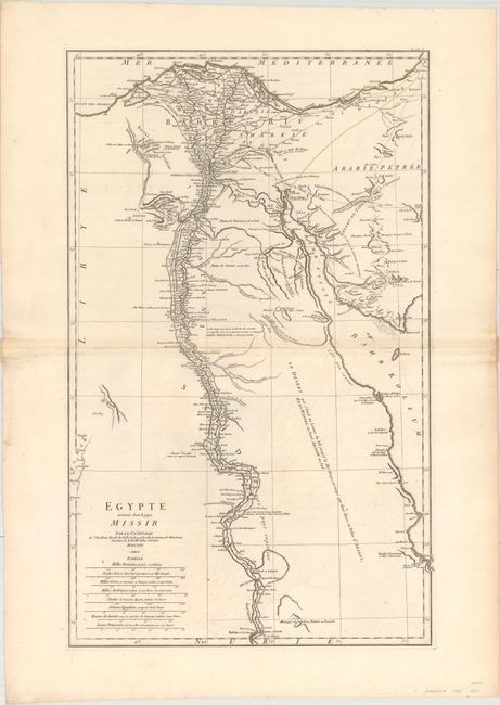
B. Egypte Nommee dans le Pays Missir, (16.3 x 26.7"). This map focuses on the Nile River valley in Egypt, with excellent detail along the river and not much additional information elsewhere. Canals, towns, roads, emerald mines, ancient ruins, and caravan routes are shown.
References:
Condition: B+
Sturdy, watermarked paper with light offsetting and minor toning along the centerfolds.