Catalog Archive
Auction 156, Lot 551

"Estats de l'Empire des Turqs en Europe, Divises Suivant l'Estendue des Beglerbeglicz, ou Gouvernements...", Jaillot/Mortier
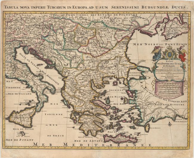
Subject: Balkans

Period: 1705 (circa)

Publication:

Color: Hand Color

Size:
24.3 x 18 inches
61.7 x 45.7 cm
Download High Resolution Image
(or just click on image to launch the Zoom viewer)

This map depicts the Turkish Empire in Europe, extending throughout the Balkans. There is good detail of political boundaries, towns, and topography. The title cartouche features the French coat of arms and two trumpeting angels. The map is based on the work of Sanson. Latin title above map: Tabula Nova Imperii Turcarum in Europa, ad Usum Serenissimi Burgundiae Ducis.

References:

Condition: B+

A dark impression with original outline color and later color in the cartouche. There is light soiling, a few minor creases at far left, and professional repairs to a centerfold separation at bottom and chips in bottom corners of sheet, with a minor amount of neatline replaced in facsimile.

Estimate: $550 - $700

Sold for: $275

Closed on 2/17/2016

Archived