Subject: Eastern Europe
Period: 1842 (circa)
Publication:
Color: Hand Color
Size:
36.5 x 21.3 inches
92.7 x 54.1 cm
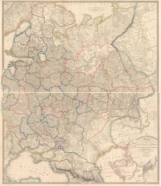
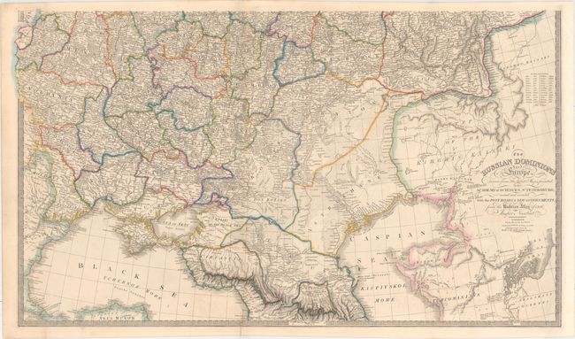
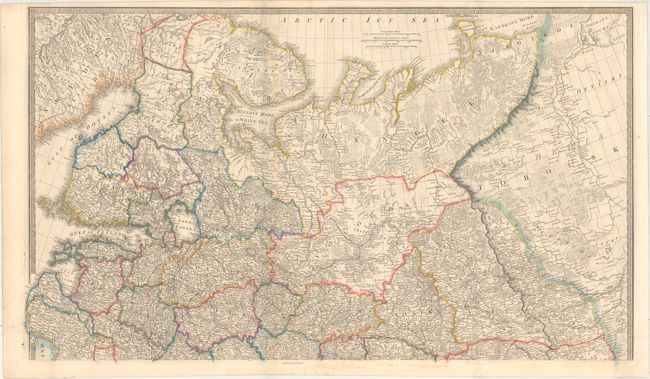
Superb, large-scale map printed on two sheets of what was then known as White Russia. The map extends north through the Ukraine to Smolensk and east to the Caspian Sea on the southern map; and includes Finland, the Arctic Sea coast, Muscovia, Archangel, and parts of Siberia on the northern map. Filled with incredible detail including the post roads, ancient ruins and interesting notations. This map was originated by Jasper Nantiat drawn from the maps of the Academy of Sciences at St. Petersburg, and was originally published by William Faden in 1806. This edition was published by James Wyld, successor to Faden, who maintained the high standard of graphic and factual excellence that had been established by his predecessor and his maps are among the finest published in the early nineteenth century. Size is for each sheet - if joined the map would measure 36 x 42".
References:
Condition: A
Original color on sturdy paper, issued folding, with a hint of offsetting and a small crease in lower left corner of each sheet. There is one short, archivally repaired fold separation in the bottom blank margin of the southern sheet. There is a faint blue shadow along the left-hand fold of the northern sheet that is caused by our scanner and does not appear on the map itself.