Catalog Archive
Auction 156, Lot 512

"[On 2 Sheets] Le Cours de la Riviere du Rhein Depuis sa Source Jusques a Son Emboucheure ou sont Distingues...", Sanson/Mortier

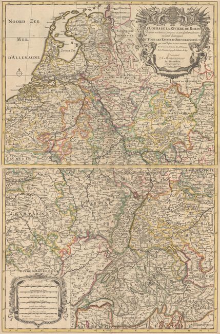
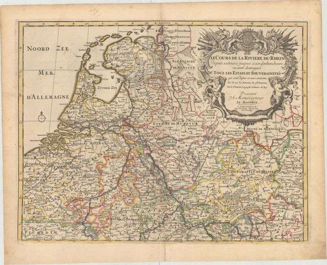
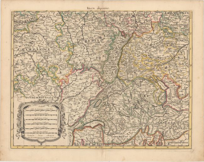
Subject: Central Europe, Rhine River

Period: 1705 (circa)

Publication:

Color: Hand Color

Size:
22.6 x 17.2 inches
57.4 x 43.7 cm
Download High Resolution Image
(or just click on image to launch the Zoom viewer)

This detailed map follows the course of the Rhine river from its source in Switzerland to the Netherlands, where it empties into the North Sea. The map extends west past Reims, France, east to Wurzburg, German, and south to Lake Como in Italy. The map is filled with detail of political boundaries, towns, rivers, and mountains. The map is adorned with two large decorative cartouches. Printed on two separate sheets.

References:

Condition: B+

Nice impressions with original color, very light toning along the centerfolds, and a couple of short separations along the centerfold that have been archivally repaired.

Estimate: $220 - $250

Sold for: $140

Closed on 2/17/2016

Archived