Subject: France
Period: 1720 (circa)
Publication: Atlas Historique...
Color: Hand Color
Size:
21 x 17.4 inches
53.3 x 44.2 cm
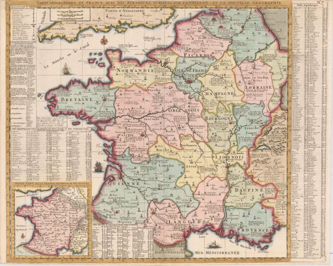
This crisply-engraved map of France shows the country divided into 16 provinces. A legend at top left identifies parliaments, universities, navy arsenals, Roman antiquities, and the locations of battles won and lost by the French. The map is filled with notations, and also includes a numbered key identifying the locations of the seven Wonders of Dauphine. A small inset map at bottom left depicts Ancient France, accompanied by a table directly above it listing various peoples according to Cesar. The information was compiled based on a map within the "commentary of Cesar" and a map by Cellarius, with asterisks denoting locations that differed between the two sources.
References:
Condition: A
Issued folding, now pressed, with a crisp impression and attractive color. Trimmed close to neatlines at top and bottom, as issued. Remnants of hinge tape on verso.