Subject: Atlantic Ocean
Period: 1661 (circa)
Publication: Klaer Lichtende Noort-Ster ofte Zee Atlas
Color: Hand Color
Size:
21.2 x 17.1 inches
53.8 x 43.4 cm
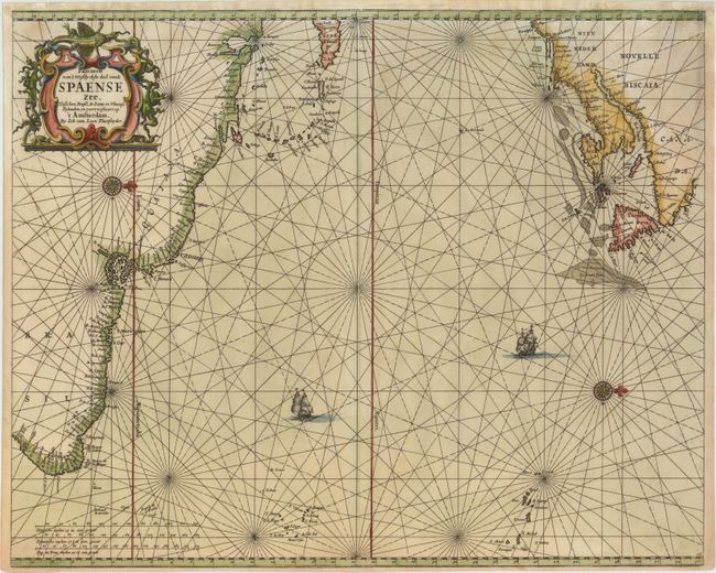
This handsome and scarce sea chart depicts the North Atlantic Ocean from Brazil to Labrador, with north oriented to the right. The map includes Hispaniola and the Lesser Antilles, as well as the coast of North America north of C. May. Van Loon based his chart on Theunis Jacobsz' Pascaert vande Carybes, Nieu Neder landt, Brazil circa 1650, however with a new orientation and English nomenclature. The settlements of Stamfort and Nieu Haven appear in Connecticut, and Pleymouth, Briston and Baston appear in Massachusetts. New Amsterdam is curiously missing. The map is adorned with a strapwork title cartouche surrounded by snakes and lizards, a compass rose, and two sailing ships.
References: Burden #368.
Condition: B+
A crisp impression with attractive color and a long, professionally repaired centerfold separation. A number of chips extending into the top border, as well as one extending 1" into the map at top right, have been professionally repaired with a portion of the border and a minor amount of rhumb lines expertly replaced in facsimile.