Subject: Ancient World & Eastern Hemisphere
Period: 1649 (published)
Publication: Parallela Geographiae Veteris et Novae
Color: Black & White
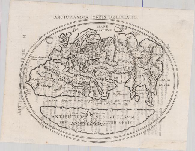
A. Antiquissima Orbis Delineatio (8.0 x 6.4"). This interesting map shows two distinct regions of the earth in antipodean balance. The inhabited Afro-Eurasian continent was balanced by an unknown, and relatively equal, landmass (Antichthones Veterum seu Alter Orbis) on the other side of an impassable torrid zone and a great boiling sea. This notion of antipodean balance and landmass equivalence continued to attract Renaissance cartographers to this otherwise outmoded Roman geographical concept. Distinguished cartographers like Mercator and Ortelius incorporated this model into an immense southern continent (Australis Incongita) to balance the known lands of the world, and the division of the world into climactic zones is still in use today. Latin text on verso with page number 86 at upper left.
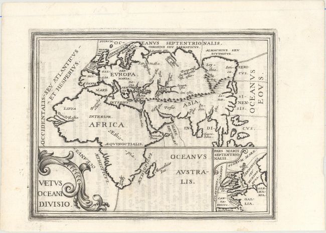
B. Vetus Oceani Divisio (7.4 x 5.7"). This small map of the old world depicts Europe, Asia and Africa. It shows the old ocean dividing line which represented antipodean balance with the southern portion of Africa now properly connected to the rest of the continent. Includes a small inset of northern Europe.
References: Pastoureau, BRIET I [14] & [19].
Condition: A
Dark impressions on clean sheets with light text show-through and a few minor repairs confined to the blank margins.