Subject: Central America
Period: 1769 (circa)
Publication: Nieuwe en Beknopte Hand Atlas
Color: Black & White
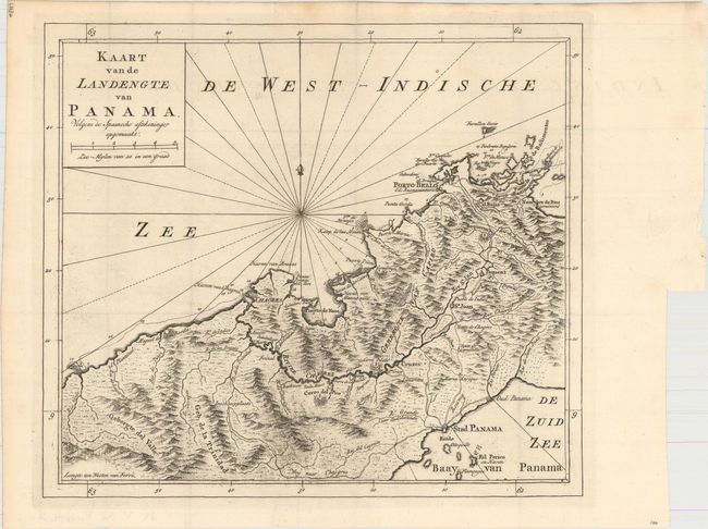
A. Kaart van de Landengte van Panama, Volgens de Spaansche Aftekeninge Opgemaakt, (12.1 x 10.6"). Great map of Panama showing Panama City at the southeast, Chagres at the northwest and Porto-Bello at the northeast. Roads and the Chagres River connect them all. Finely engraved with rhumb lines and fleur-de-lis. Very detailed and fully engraved to show topographical information. Condition: Very faint offsetting, otherwise fine. (A)
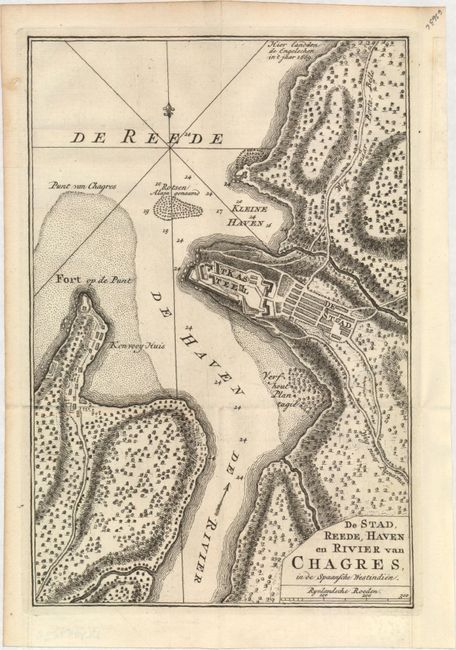
B. De Stad, Reede, Haven en Rivier van Chagres, in de Spaansche Westindien, (6.8 x 10.1"). Copper engraved plan of this important port on the Atlantic coast of Panama. The map provides a terrific picture of the river, town, castle, fort and countryside. Details include soundings, shoals, rocks and roads. Condition: Minor toning along left edge of sheet. (A)
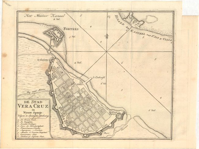
C. De Stad Vera Cruz in Nieuw Spanje: Volgens de Spaansche Aftekening, (8.8 x 7.2"). Attractive plan for the important port of Veracruz in the Gulf of Mexico. Veracruz was the first port established in New Spain by Hernan Cortes in 1519, and later was a scene of many battles during the ensuing years. Across the bay is St. Juan d'Ulloa. Condition: A few faint spots of foxing mostly in the blank margins. (B+)
References:
Condition:
All dark impressions on sturdy, watermarked paper. Issued folding. See description above for additional details.