Subject: World & Ancient World
Period: 1713 (published)
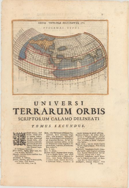
Publication: Universus Terrarum Orbis
Color: Hand Color
On full sheets of Latin text measuring 9.5 x 13.6".
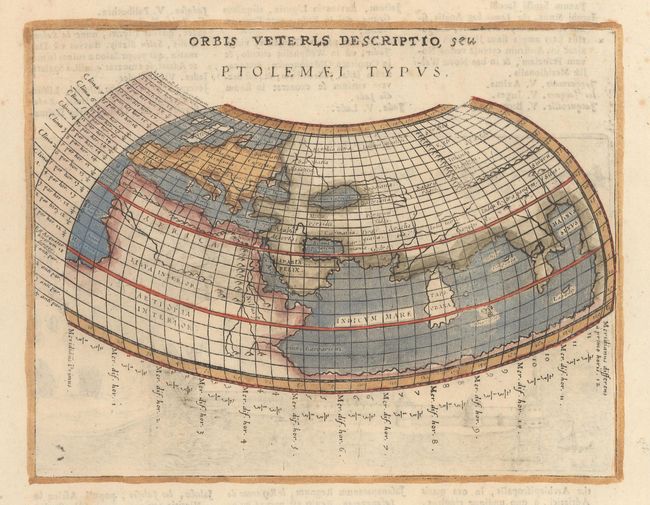
A. Orbis Veteris Descriptio, seu Ptolemaei Typus, by Giovanni Antonio Magini (7.0 x 5.4"). This Ptolemaic map describes a landlocked Indian Ocean containing a huge Toprobana (present day Sri Lanka) and a virtually nonexistent Indian subcontinent. The source of the Nile is located in a range of mountains south of the Equator, known as the Mountains of the Moon. The map is printed on the title page of the second volume with an engraved view of a fortification on verso. Originally published by Magini and engraved by Girolamo Porro. Reference: Shirley #193. Condition: Minor show-through of text on verso and a few soft creases. There are a few faint spots of foxing confined to the blank margins. (A)
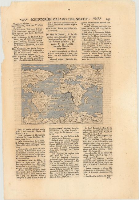
B. [Untitled - World], (5.7 x 4.1"). An interesting mariner's map reflecting the geography of the late 1500's. First issued in 1597 and republished by Lasor a Varea. Most of the world is depicted centered on the Atlantic Ocean and featuring a huge southern continent Terra Incognita. The northwest coast of North America and Asia east of India are not depicted. The oceans are stipple engraved and rhumb lines cross the map. Condition: Light toning and one tiny spot near Ireland. (B+)
References:
Condition:
See description above.