Catalog Archive
Auction 156, Lot 315

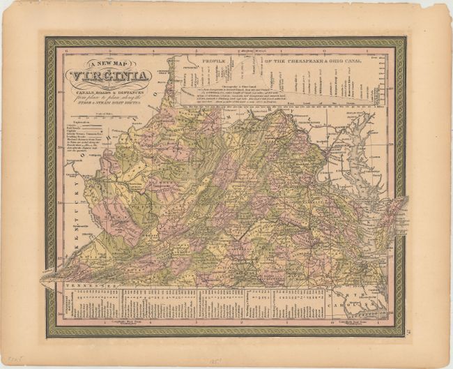
"A New Map of Virginia with Its Canals, Roads & Distances from Place to Place, Along the Stage & Steam Boat Routes", Mitchell, Samuel Augustus
Subject: Virginia

Period: 1851 (circa)

Publication: A New Universal Atlas

Color: Hand Color

Size:
14.3 x 11.6 inches
36.3 x 29.5 cm
Download High Resolution Image
(or just click on image to launch the Zoom viewer)

An attractive map that shows Virginia ten years before West Virginia separated itself due to the secession of Virginia from the Union. There is nice detail of the counties, cities, roads and railways. At top is a profile of the Chesapeake & Ohio Canal, part of which was in Virginia along the Potomac River. A table at bottom lists Steam Boat Routes - Richmond to Norfolk, Richmond to Washington, Richmond to Baltimore, Wheeling to Pittsburgh, and Wheeling to Cincinnati. The legend identifies canals, railroads, capital cities, leading roads plus distance along roads in miles. Fancy titling and decorative border. Published by Thomas, Cowperthwait & Co.

References:

Condition: B+

Full original color with light toning.

Estimate: $160 - $190

Sold for: $120

Closed on 2/17/2016

Archived